One of the reasons why we enjoy staying in state parks is that there are usually trails right in the park and we don't have to get in the car and drive to a trailhead. Blackmer Loop Trail, according to our trail guide book - Best Easy Day Hikes: Colorado Springs - "is not only one of the best easy day hikes in ... Cheyenne Mountain State Park but also in the entire Colorado Springs area." Since we are still "catching up" on our internet work (having been off-line for all of last week), we really appreciated that the trail passed right by our campsite and we had that "driving time" to do more computer work.
Before we go hiking, one more comment about our transition from Arizona/New Mexico to Colorado.
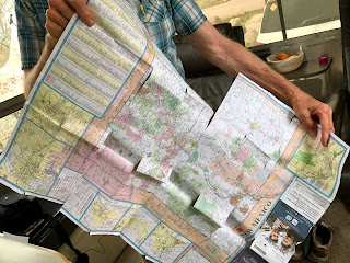
We are frequent visitors to AAA stores throughout the country where we acquire a variety of guides and maps. We use low-tech paper maps to plan our stops and routes and when we are traveling, we following along the highways shone on the map. Here's the Arizona (on one side)/New Mexico (on the other) map that we used for the past four months.
We did a lot of traveling as we zig-zaged across these two states trying to keep in the warm weather during the winter by staying south, and gradually moving up the states as the weather (mostly) got warmer. In addition to this AAA map, we also used the official state tourism maps, but not as much as this one! Thank you AAA.
Beginning the hike at the base of Cheyenne Mountain (9,565-foot).
This rather secluded hike traversed through grassy meadows, scrub oak thickets, and ponderosa pine woods. Here a Ponderosa pine is growing from a crack in a 10-foot-high granite boulder.
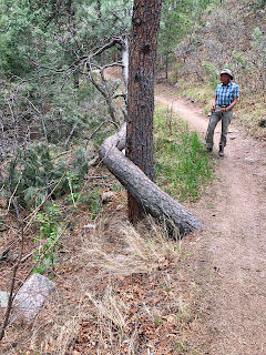
This pine tree is trying to snake around another.
Wildlife - a turkey.
Today's hike:
Length - 4.7 miles
Duration - 1 hour, 56 minutes
Elevation gain - 450 feet (45 floors on the Fitbit)


No comments:
Post a Comment