Tuesday, January 31, 2017

Sonoita Creek-Blackhawk Canyon Loop Trail, and beyond

We strung together a few trails for today's hike in Patagonia Lake State Park.

The first trail, Sonoita Creek Trail, was dry but presented us with this lovely lavender prickly pear.

Another trail was called Vista Trail and had this and...

this vista to reward us.

Towards the end of the Vista Trail we encountered these cows contemplating the view.

The homeward trail was through Blackhawk Canyon. We found a place to eat our lunch after which we hopped the rocks across this Patagonia Lake outflow creek.

Lunch view of a refreshingly blue pond.

Blackhawk Canyon contains the outflow creek of Patagonia Lake and this section had some nice waterfalls. (As usual, if you click on the picture to enlarge it you can see more detail.)

Looking down the canyon from the falls.

As we climbed the canyon walls we saw various streams.

One end of Patagonia Lake by the spillway.

Today's hike:
Length - 5.60 miles
Duration - 3 hours, 34 minutes (including lunch)
Elevation gain - 550 feet (59 floors on the Fitbit)


Monday, January 30, 2017

Patagonia Lake State Park

Today is Monday and we often move on Monday, as we did today. Tonight we are in Patagonia Lake State Park, about 10 miles from Nogales (both in Arizona and in Mexico) and the Mexican border. In fact, today we went through a border check-point. This afternoon when we arrived it was quite warm, we opened all the windows and put on the Fantastic fan.

These first three pictures are on the drive south of Tucson.


This welcoming sign to Sonoita is a town about 20 miles north.

They seem to like metal sculpture around here. This one is on a hill just on the edge of town - Patagonia.

It's a 5-mile drive off the highway, Arizona #82, to the Patagonia Lake State Park gate.

Arrived.

This sunset view (we're practicing taking sunset pictures) is a fairly typical scene at our last RV site in Picacho Peak State Park. That's the moon in the upper left.


Sunday, January 29, 2017

King Canyon Trail

The King Canyon Trail is in the Tucson Mountain District of the Saguaro National Park. The park is divided into two units separated by 30 miles and the city of Tucson. The trail was a strenuous trek with the trailhead just across the road from the Arizona-Sonora Desert Museum where we went yesterday. 

We are learning quite a bit about the saguaro. One does not refer to the limbs as branches, but as arms. Saguaros grow slowly, taking about 15 years to reach 1ft in height, 50 years to reach 7ft and almost a century before they begin to grow their arms, if they grow them at all; some specimens never grow arms. No one really knows how long saguaros live, but the supposition is that the oldest are well over 200-years-old.
The hike today was through a more desert-like environment than our previous ones.

Lovely blooming barrel cactus along the side of the trail.

Our lunch spot on top of Wasson Peak at the end of the King Canyon Trail.

Other hikers enjoying the 360 degree view from on top of Wasson Peak.

That's Tucson in the center of the picture (be sure to click to enlarge).

If you enlarge this picture you can clearly see the trail that we climbed to the top of the peak.

As we began to descend, another hiker arrived at the Wasson Peak register. She took this white dress from her backpack, and put it on over her hiking clothes and the long white gloves. I asked if she wanted us to take her picture, and she said, "yes". She said that she and some of her friends climb mountains and then take their picture in a dress - just something they do. She had climbed Picacho Peak earlier this week using the cables, ladders and catwalk. We told her we do something similar with Mr. Spock.

Descending from the peak.

Looking back up at Wasson Peak.

Today's hike:
Length - 7.2 miles
Duration - 4 hours, 25 minutes (including lunch)
Elevation gain - exactly 2,000 feet (213 floors on the Fitbit)

Saturday, January 28, 2017

Finding the Bobcat

Home to cacti, coyotes and palm-sized humming-birds, the Arizona-Sonora Desert Museum is one part zoo, one part botanical garden and one part museum. Desert animals, from javelina to coyote inhabit natural enclosures. We were most interested in the desert plants and opted to join a docent-led "orientation" to the desert. Read more at -

https://www.desertmuseum.org

While we were waiting for our tour to begin, other docents were highlighting a desert constrictor and a kangaroo mouse.

Meet Gary, our docent. He told us he spent many years in Alaska doing something with large animals, but now that he is in Arizona, it's the flora and desert plants that "sing" to him. We were glad because that is just what we were interested in, too.

I didn't take ay pictures of the cacti and other plants Gary talked about because I was too interested in what he had to say and we also bought two heavily illustrated books on cacti in the gift shop. As we have found out in the past, the more you know about the plants and animals in your surroundings, the more interesting the hiking can be. In fact, just walking through the campground this evening, Frederick identified many creosote trees that we had never noticed before. 

But there are desert animals at the Museum who live, according to Gary, in the second most lauded natural environments for captive animals.

Strawberry, the bear. 

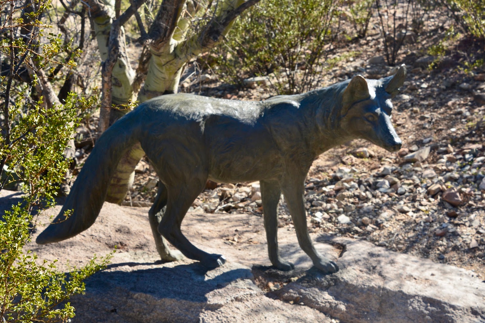
Duke, a Mexican wolf.

At an overview at the Museum Gary talked a bit about the geology of the area and the use of water.  The picture above also shows people walking the 1/2-mile desert loop trail. (Gary wore a big button that read "Lets Talk Climate Change".)

There was a large enclosure for coyotes - maybe two acres or more - but the animals were all sleeping under trees or rocks so I opted for a picture of one of the sculptures.

In the last few days we have heard about javelinas and Frederick was particularly interested in seeing one. Although they look something like a pig, they are only distantly related.

They sure look like pigs to me!

Can you see the bobcat? (He is much easier to see if you click on the picture to enlarge it.)

We were very fortunate to see the local ocelot. Usually this cat hides out in its enclosure.

There are two walk-through aviaries, one devoted just to hummingbirds.

If you enlarge the picture you can just make out the rapidly fluttering wings.

Friday, January 27, 2017

Romero Canyon Pools

Having exhausted the trails in Picacho Peak State Park, we drove 40 miles south and east to Catalina State Park and hiked the Romero Canyon Trail as far as the Romero Pools. It was a perfect day for hiking, cool (50s), and a bright blue sky.

The first mile was a fairly flat approach to the base of the Santa Catalina Mountain range before we began our climb to the upper reaches.

Trail passing through the Montrose Canyon. 

Climbing steeply, the route occasionally switchbacks as it gains the rugged north face of Montrose Canyon.

Fast flowing stream at the base of the Montrose Canyon drainage. (Click on the picture to see the stream.)

If you click on this picture you can see a mountain in the far distance; such mountains are called "sky islands" in Arizona. That's the Tucson sprawl in the valley below.

A real treat was encountering a blooming Century Plant.

Spectacular!


Lunch spot by the edge of the pools.

These pools exist all year, just not as full and as fast moving.
Today's hike:
Length - 5.51 miles
Duration - 4 hours (lunch included)
Elevation gain - 900 feet (118 floors on the Fitbit


Thursday, January 26, 2017

Westernmost Skirmish of the American Civil War

We never expected to find a Civil War site in our travels to an Arizona State Park, but one of the last Civil War skirmishes was fought at the base of Picacho Peak. At the outbreak of the Civil War in Mid-April 1861, Union soldiers were withdrawn from Arizona and New Mexico territories. The Confederates expanded into the southwest, as a gateway to California. Confederates occupied Tucson in the summer of 1861 and lookouts were stationed at Picacho Pass.

In response U.S. President Abraham Lincoln ordered the creation of the California Volunteers unit. This force was to advance into the New Mexico Territory and block the Confederate forces. On April 15, 1862, a Union scouting party of about 25 men encountered the lookouts at Picacho Pass. Three Union soldiers died and three Confederates were captured, the rest escaping to Tucson to warn their comrades. Confederate Capt. Sherod Hunter ordered his outnumbered troops to leave Tucson on May 14, retreating to New Mexico The Union troops arrived in Tucson on May 20, 1862 putting an end to Confederate incursions in the Southwest.

https://en.wikipedia.org/wiki/Battle_of_Picacho_Pass

We walked over to the Civil War battle site near the Visitor Center where every year there is a re-enactment of the skirmish.

There are a number of displays including this monument erected by the Daughters of the Confederacy.

Later this afternoon we drove back to Eloy where the closest grocery is located, an IGA, 13 miles away. On the way back Frederick took this landscape picture of Picacho Peak and the point we climbed to on yesterday.

Today's hike:
Length - 3.4 miles
Duration - 1 hour, 10 minutes
Elevation gain - 310 feet (31 floors on the Fitbit)