Saturday, March 17, 2018

Joshua Tree National Park

Since March 7 we have been exploring Joshua Tree National Park, the eastern half, the Colorado Desert part of the park, while we were staying in Indio and the western half, the Mojave Desert section, from Twenty Nine Palms. 

Hike to Mastodon Peak in the Colorado Desert.

The Mastodon trail travels to the Mastodon Mine.

Hike to the Lost Palms Oasis in the Colorado Desert.


View of the Salton Sea from the trail to Forty Nine Palms.

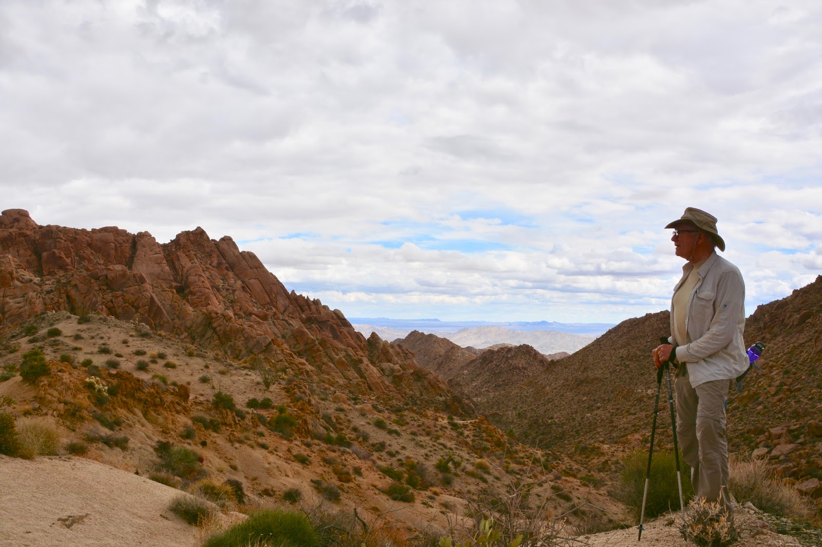
When we moved to Forty Nine Palms, the first hike we took in the Mojave Desert section was up Ryan Mountain.

View from Ryan Peak.

Joshua Trees only grow in the Mojave section of the park.
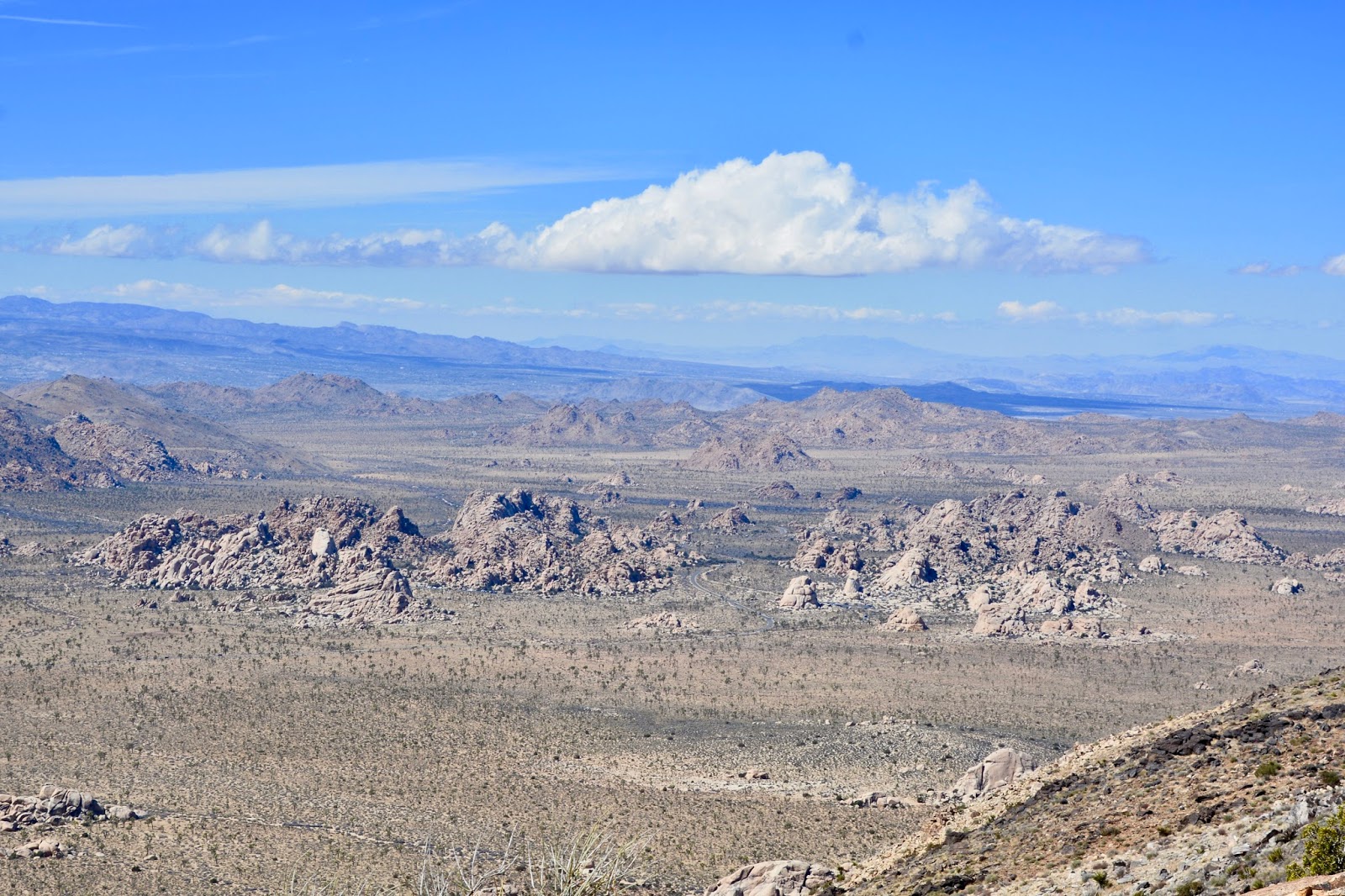
From Ryan Mountain.

Dave and Wendy from outside Vancouver. They gave us a bottle of water when they noticed that we had foolishly forgotten our water bottles. They are also going to be in Jasper National Park in July, in the same loop, 56, that we will be staying in.

Wendy took this picture of us on top of Ryan Mountain.

Along the Barker Dam trail.

Early cowboys originally built Barker Dam to collect water for cattle.

Just beyond Barker Dam...

where there are some petroglyphs.

We took another trail to the Wall Street Mill. 

Forty Nine Palms Oasis behind Frederick.

Lovely Forty Nine Palms Oasis.


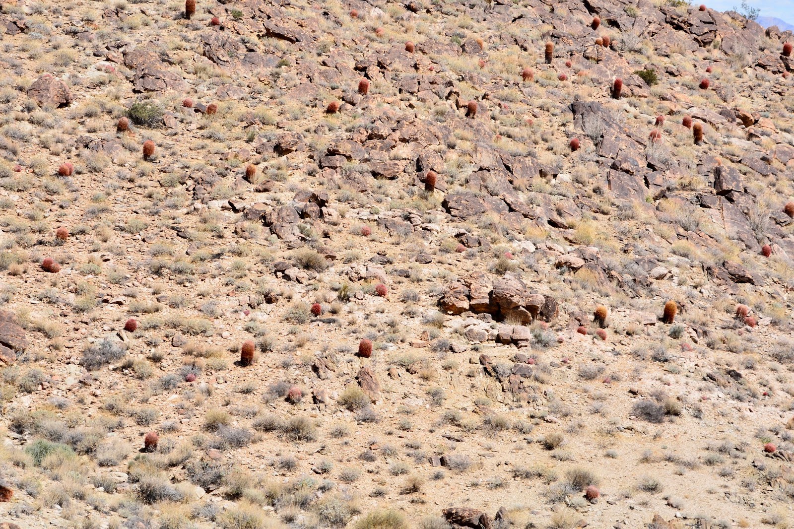
The trail to Forty Nine Palms passes by a display of barrel cacti.

Joshua Tree hikes:

Mastodon Peak Loop-
Length - 2.46 miles
Duration - 1 hour, 21 minutes
Elevation - 422 ft (43 floors)

Lost Palms Oasis -
Length - 7.76 miles
Duration - 3 hours, 56 minutes
Elevation - 1,332 feet (134 floors)

Ryan Mountain-
Length - 3 miles
Duration - 1 hour, 51 minutes
Elevation - 1,059 feet (106 floors)

Barker Dam and Wall Street Mill-
Length - 3.79 miles
Duration - 1 hour, 55 minutes
Elevation - 180 feet (18 floors)

Forty Nine Palms Oasis -
Length - 3.37 miles
Duration - 2 hours, 1 minute
Elevation - 784 feet (79 floors)

Monday, March 5, 2018

Venturing4th in 2018

Dear Family and Friends,

 We are finally back on the road after six months of enjoying the holidays and visiting with family and friends. It was a productive and enjoyable few months, but we are now heading for Southern California where we will enjoy the rest of the winter before heading north through Nevada, Utah, Montana into Canada where we will again spend the summer months.

Before we launch into a description of our exciting stop at a geo-site, we would like to tell you about our plans for this blog - Venturing4th. We began blogging in early 2014, at the start of our travels in the Airstream, and were fairly consistent in blogging on a daily basis for the past four years. There were two reasons for the daily blog - 1) to keep family members apprised of where we were and what we were doing and 2) to keep a travelogue for our own enjoyment and to remember what excellent adventures we've had. Along the way we have acquired a nice following of fellow travelers and friends who have asked to travel along with us via the blog. 

While we enjoy blogging, daily blogging is beginning to seem repetitive. So, for this year, we would like to blog on an irregular basis, when scenery and adventures warrant. We don't know how often that will be, but we hope that when the blog arrives in your mailbox, you'll welcome the opportunity to share with us our continuing travels.

As mentioned above, we are traveling west through Texas toward California. This past weekend, as we neared western Texas, Mr. Spock spoke up from the back seat reminding us that there is a geo-site on the western border of Texas and New Mexico in Guadalupe Mountains National Park. Millions of years ago these mountains were part of a tropical reef, populated by sponges, algae, and other ocean creatures.

When the water receded, natural forces buried the reef, then pushed it skyward and sculpted the limestone peaks now in the park. The highest part of the more-than-40-mile range is preserved in this West Texas area, where more than 80 miles of trails weave through rocky cliffs, oak and maple forests, and desert scrub. The park is also home to Guadalupe Peak, the highest point in Texas.

Frederick and Mr. Spock admiring the sandstone slopes and the cliff-forming limestone wall of El Capitan.

A panoramic collage of one of the best examples of an ancient fossil reef on Earth.

After a stop at the Visitor Center, we started on a hike that began at the Frijole Ranch, an historic structure that now houses a museum.

Starting out on the trail we passed a number of these cone-shaped hills.

Frijole Ranch was constructed at this site because of Frijole Spring that provided water that was essential to survival here in the desert.

We hiked the Smith Spring Trail where, half-way up a ridge, we came to Smith Spring.

Can't tell you how glad we are to be back on the trail!

Today's hike:
Length - 2.7 miles
Duration - 1 hour, 30 minutes
Elevation gain - 688 feet (70 floors on the Fitbit)