Thursday, August 27, 2015

Big City Life

We have thoroughly enjoyed visiting with Marlene, Elizabeth, James and Thomas in Coeur d'Alene, Idaho. Today we even visited the local County Fair and enjoyed seeing the livestock, Arts & Crafts and 4-H kids with their animals. A highlight for Grandpa was seeing the miniature horses, particularly two mares with their recent foals.

Tomorrow with leave the trails, mountains and small town living for the Big City Life. We fly out of Spokane for Cincinnati and Mike and Kelly's wedding on Saturday. Since I'm sure it will be a big culture shock for us, and we will be busy partying and visiting relatives and friends, the blog will be taking a little break to adjust. We will be back on Tuesday, September 1.

Proud Grandpa with James, Elizabeth and Thomas.

Wednesday, August 26, 2015

Hnmulshench

When we came to Liberty Lake Regional Park we were just looking for a place that would be near Coeur d'Alene so that we could visit with Marlene and her family and be close to Spokane so that we could use the airport to fly to Cincinnati for Mike and Kelly's wedding. What we didn't expect to find was a great hiking trail. But here it is, the Liberty Lake Loop Trail, which does not circle the lake but climbs up into the surrounding forest to an elevation of 4,720 feet. 

The landscape where Liberty Lake Regional Park sits was once rich wetland until it became a ranch and the wetlands were drained for agriculture.When the ranch became a park, Ponderosa pines, cottonwood and aspen moved into the drained wetland. The cottonwood and aspen attracted beavers who built dams and created ponds and the wetter soils caused the pines to die. But, a new wetland is now forming, creating wildlife habitat and improving water quality in the area.

The Coeur d'Alene Indian word for beaver, our old friend, is hnmulshench. Before they were trapped into near-extinction, there were over 2 million beavers in Eastern Washington. Beavers are clever problem-solvers, skilled builders, and talented engineers - and the mascot of California Institute of Technology, Caltech. 
Along the trail, evidence that beaver have been at work.

A tree felled by beaver that is adjacent to a dam that is causing water to back up and cover the land.

One of the main attractions of the trail are the red cedar trees. Here Frederick is standing in a grove of cedar trees that are majestic in size.

What a wonderful legacy for the people to enjoy.

Further along the trail we continued among the cedars. 

Fortunately there was a sign because the waterfall was pretty much dried up.

Just a trickle of water at the falls and...

a cascade near the mid-point of the trail.


The first half of the trail was classic elevation gain through switch backs, but the last half follows an old logging road that is a great route for mountain biking. At the mid point we met Dale who had ridden up on his bike and was resting before he returned to the trail. He lives in Liberty Lake and was able to tell us a bit about its history.

On the way down there were some open views and we could tell that the smoke was not as bad today as it was yesterday.

About 3/4 of the way around the loop we met Galen Denio. He is of French and English heritage and at one time his family lived in Deerfield, Massachusetts. We had a most interesting conversation with him about the geology of Eastern Washington and the ice age floods.


Shortly after we left Galen these equestrians came by, enjoying the trail. The third horse in the picture was just a yearling and was wearing only a halter with no lead. He followed along; probably one of the other horses was his mother. 


Tuesday, August 25, 2015

Leaving Canada... at least for a while

Sadly, we left the Canadian Rockies today, but we will be returning later in September when we visit both Glacier National Park in the U.S. and Waterton Lakes National Park in Canada. For right now, we are in Liberty Lake, Washington, the first town in Washington, on Interstate #90, across the border from Coeur d'Alene, Idaho. Tomorrow we will be visiting with Marlene and her family and on Thursday we fly out of Spokane for Mike and Kelly's wedding in Cincinnati.  

As we mentioned yesterday, the forest fires in Washington state are having a huge impact on the air quality in Canada. Last month when we did this drive we were able to enjoy the fine scenery. Today it was just a memory.

It was kind of eerie. 

We passed through a community called Hoodoos, B.C. At least these features showed up more clearly because they were right beside the road.

Hoodoos are always interesting.

Columbia Lake outside of Fairmont Hot Springs.

Even through the haze we could enjoy the scenery.

We stopped for lunch overlooking Moyie Lake, just north the U.S. border, so we could be sure to eat our sliced apples in case Customs wanted to confiscate them. Looks like an ideal setting for lunch.

Actually we were at a roadside overlook. 

Monday, August 24, 2015

Rockwall - Floe Lake Trail

Between the end of June, yesterday and today, we have travelled 25% of the trails in Kootenay National Park, there being only 125 miles of hiking trails in the whole park. Many of trails show the effects of a lightning caused, devastating forest fire in 2003 that burned 12.6 % of the park. We first experienced the impact of the fire when we took the guided hike to the Burgess Shale along the Stanley Glacier trail in late June with Peter and Vian.  Most of the forest in the Floe Creek valley, today's hike, burned in the 2003 fire.

It was a little like walking through a dwarf forest with the silver-grey trunks of the burned forest towering over the new growth.

The trail descends to cross the Vermilion River.

The river's name, Vermilion, refers to the red stains of iron oxides found along its banks, upstream. We followed this beautiful, blue-green river 1 mile before we reached the narrow valley of Floe Creek.

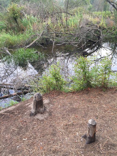
Floe Creek Valley is narrow with many run-off streams down the steep sides. This one was choked with logs.

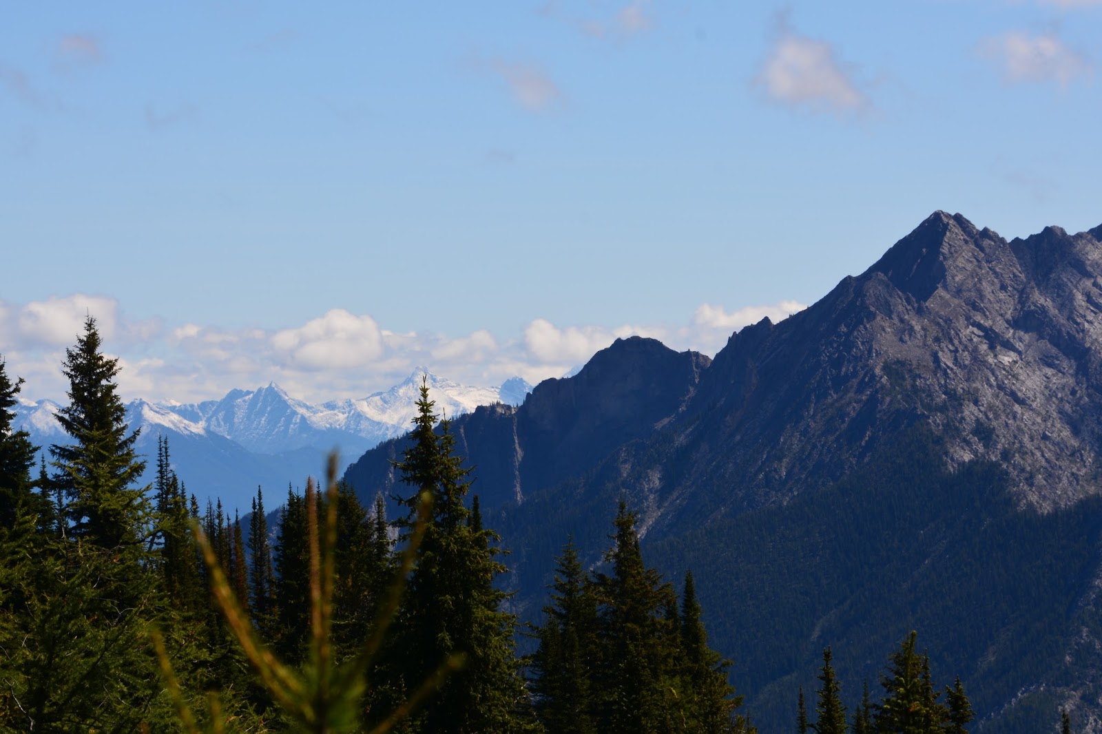
Three miles along the trail, when it was time for a snack, usually a protein bar, we came across this "bench" that someone had constructed beside the trail, complete with a Christmas tree. We sat right down and enjoyed a bar and the view.

This was the view.

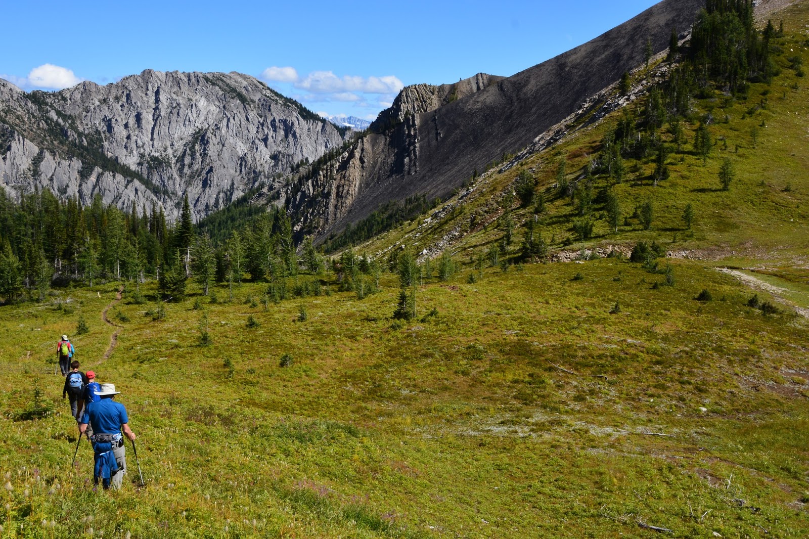
The trail was a steady climb through the valley until the 3.4 mile mark when we began a series of switchbacks up the side of Numa Mountain - 1,312 feet in 2 miles - a tough climb. Here is the reward.

Floe Lake, with glaciers at the base of the cliff, to the south,...

straight across the lake, west, and...

to the north. 

Floe Lake occupies an inspiring setting at the base of the Rockwall, a cliff that extends 33 miles through western Kootenay and southwestern Yoho national parks. In places this rampart is almost 3,000 feet high. Up close, the rock looks like zebra stripes - alternating layers of darkish limestone and paler dolomite.

We ate our lunch on the beach, sitting on a zebra striped rock, with this as our view to the north and...

to the south.

These ducks, with elegant heads and necks, swam back and forth in the clear, blue water.

A closer view of the Rockwall with its striped rock.

We first met Gisele and Eder (a Basque name pronounced Edth -er), from Barcelona, along the trail - Gisele with her boot off and both of them trying to protect her heel from a forming blister. We offered mole-skin, scissors and tape from our First Aid kit and showed them how to apply it. We left them with the supplies and asked them to return the scissors to us when they reached the lake.

Here are Gisele and Eder enjoying the sunshine at the beautiful lake.

There is a back-country campground at the lake and these bear-proof food lockers are provided. 

Both at the lake, and especially on the way back down the valley, we noticed that the sky was hazy and I'm sorry that the pictures are not clearer. The camera seems to pick up the haze and the pictures are not sharp. We're not sure why there was so much haze; someone suggested that it is from forest fires in the region.

Floe Creek occupies a steeply walled, V-shaped valley, sculpted more by the effects of erosion from flowing water than by moving ice. The steep slopes become natural paths for snow avalanches. Avalanche slopes comprise almost half the area along Floe Creek.

I have a confession to make. When we passed through the valley in the morning, the air was a lot clearer but I had decided to take pictures on the way down, our usual approach. Maybe I should learn from today and take a clear picture when I have the opportunity.

Trail statistics:
Distance:  14 miles
Elevation gain: 2,346 feet; 326 floors on the Fitbit
Time: 7.5 hours (including lunch & pictures)

Sunday, August 23, 2015

Kindersley Pass - Sinclair Creek Loop

I don't know if the Canadian Government planned it this way, but the Parks Canada restriction requiring hiking in a group of four or more in bear country created a situation where we met four cheerful and thoroughly delightful Canadians, and caused us to have a better than average hiking day. What a great way to promote Canada!

We arrived at the trailhead ready to experience "one of the most spectacular day hikes for views... in the southern part of Kootenay National Park... offering fabulous views." (Gem Map trail description for Kootenay National Park) Then we encountered the dreaded notice that the trail was closed to hiking except under restricted conditions. What were two hikers to do? Well, at that very moment, a car pulled up and out hopped 4 people clearly excited about taking the trail so we asked if we could tag along. Despite our white/grey hair, they said, "Yes", - it was our lucky day!

Meet Bernetta & Adrian, from Calgary, and John & Kim, from Saskatoon, Saskatchewan. Bernetta and Kim are old friends. Bernetta and Adrian are just finishing up their summer vacation and had completed the Rockwall, 4-day backcountry hike and were meeting John and Kim for this day-hike before they return to Calgary. 

Along the trail we met David, a volunteer engaged in trail maintenance. These dedicated folks love the park and work to keep the trail enjoyable for the rest of us. He was busy cutting downed trees that had fallen across the trail and sculpting waterbars to enhance trail drainage. We thanked him for his efforts.

On the way up, through mostly forested areas, we crossed an avalanche path across a valley and had open views of some of the surrounding peaks - a promise of things to come.

Further up we briefly stopped and looked up at the trail ahead that crosses avalanche gullies with Kruppleholz tree islands dotting the mountainside. We noticed several hikers on the trail - perhaps you can too, in the middle of the picture.

The trail sign at Kindersley Pass offers tantalizing views of what is to come. Kim is pretty psyched, having just climbed 875 meters (2400 feet).

Kindersley Pass straddles the boundary between Kootenay and Banff National Parks. Frederick has just climbed 2400 feet, too!

As we continued on the views became more and more expansive.

Our turn to begin the most memorable section of the trail through sub-alpine terrain and across open slopes to where we...

topped out at barren, windswept Kindersley-Sinclair Col (or summit), a small saddle between two slightly higher peaks.

Magnificent views opened up all around us.

It was a wonderful moment to share.

The trail description says that "those with time and energy to spare can scramble up the ridgeline to panoramic views from the rocky peak (unnamed) to the southeast." Our four hiking companions decided to "run" up the peak - while Frederick and I stayed behind to guard the backpacks.

This is the unnamed peak on the other side of the Col.

While we watched their progress up the peak, we had time to eat our lunch and take in the view.

Pretty amazing and...

impressive.

From down below, we captured their accomplishment with the telephoto lens.

Time to go down through another avalanche basin at the head of Sinclair Creek. 

Look-back at Kindersley-Sinclair Col.

Down into the valley.

We found these rare mushrooms that Bernetta identified as "coral" mushrooms.

Look-back at the peak conquered by the intrepid-four.

Crossing a meadow where fall color is beginning to show.

Sinclair Canyon with Sinclair Creek at the bottom.

We hiked the trail as a loop, with the trailheads separated by 1.2 km. The best part is that John and Kim had parked their car at the Sinclair Creek end and we were able to ride in their car to the trailhead for Kindersley Pass, where Bernetta and Adrain had their car and where ours was, too. 

Statistics for the hike:
Distance: 10.8 miles
Elevation gain: 3,461 ft. or 375 floors (our record for most elevation gain in a day)
Duration: 7+ hours