Tuesday, August 30, 2016

Drive to Haines

Located on the shores of Kluane Lake, the largest lake in the Yukon. Destruction Bay is one of several towns that grew out of the building of the Alaska Highway. It earned its name when a storm destroyed buildings and materials here.

When we left this morning at 7 a.m. (which means getting up at 5 a.m.) it was in the upper 30s. Winter is coming on in the Yukon. But, it was another fine day for viewing stupendous scenery, so let's get going!

The RV park in Destruction Bay was right across from Kluane Lake, the largest lake in the Yukon.

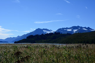
I love the fall colors below and the fresh snow on the mountain tops. You can see the snow line. 

We were just passing Tachal Dhal, formerly known as Sheep Mountain, when we we saw some.

They were all the way up the side of the mountain, and...

clustered on the road.


The snow line is very visible in this picture.

More fall color.


This is an intriguing drainage pattern on the side of this mountain.

At Haines Junction in Yukon, we turned south on the Haines Highway, 146 miles to Haines, Alaska. Noted for its grand views of glaciated mountains and the variety of its scenery - from wooded hillsides to alpine tundra, then back to coastal forests.

No trees in the alpine tundra.

Glaciated mountains.

One of these is Jarvis Glacier and another is Saksaia Glacier. 

Passing right through Canadian Customs on the right side of the road.

U.S.Customs, Dalton Cache crossing.

And just like that, we were back in Alaska!

The road winds through the Chilkat River flats outside Haines.

We're glad to be here!


Nunataks and the Drive to Tok

Blog for August 28

For a brief time today I thought we had found the definition of the one remaining word on Bill’s list that we couldn’t identify - Nevroks. On our drive from Valdez to Tok today, we stopped at the Visitor Center of Wrangell-St. Elias National Park and Preserve. One of the exhibits identified Nunataks which are small rocky islands, the tops of mountains poking through the glacial ice that provide a refuge for some hardy and adaptable plant and animal species. These islands are call nunataks - “land place” in the Inupiaq language. But, alas, when I checked the words, even though they both began with “N” and had lots of vowels and unusual letters, were not the same. We continue to be baffled by Nevroks.

However we were lightly impressed with Wrangell-St. Elias National Park, America’s largest, by far, National Park. 13.2 Million acres. In the collection of pictures, below, from today’s drive, are some of the spectacular mountains in the park that are visible from the road. 


Here’s our journey for today - 

Tok in the early morning light.

Keystone Canyon in the morning light.

Richardson Highway in the sunlight. This time we could see the surrounding mountains.


Twenty-seven mile Glacier.

Worthington Glacier

Fall color on the mountainside.


Mt. Drum, in Wrangell-St.Elias National Park,  from the south.

Views of Mt. Drum, on the left, and Mt. Sanford on the right.

Close-up of Mt. Sanford.

Close-up of Mt. Drum.

Along the Tok Cutoff.


Along the highway through Tok.

Shoup Bay Trail

Blog for August 27, 2016

Surrounded on three sides by steep snow-capped mountains, Valdez offers the most dramatic mountain views we've seen in any of the port towns we've visited. And I always thought it was just the southern terminus of the Trans-Alaska Pipeline with oil tanks! With all this beauty around there was bound to be some good hiking and I think we found the best scenic hike although the trail wasn't in the best of shape because of all the rain and the Alder that covers the sides of the mountains. The trail, when it began to climb the side of the mountain was created by some type of giant weed-wacker that used red licorice-sized plastic rope to cut through the tangle of Alder.


The first mile  and quarter of the trail was along the the shore of the Valdez Arm of Prince William Sound.


It was muddy and yucky, but we came upon a number of streams flowing down from the surrounding mountains that had spawning Silver Salmon. 

Huge fish, about 24 to 30 inches, in a small stream. They make a tremendous thrashing in the water.

The trail also led to access points along the shore where there were lots of active birds.

They were making quite a bit of noise.

Magnificent views down the Sound.

Same view a little further down the Sound. We are about 500 ft. above the water at this point.

Even though the trail continued, our goal was the Gold Creek bridge at Mile 3.5. When we arrived at the bridge we found that the access stairs had been washed away and there was a make-shift log in their place.

When we got to the other side we looked back and saw the stairs a little further down the creek.

When we crossed over the bridge we came upon a rather primordial forest with a trail that led to Gold Creek Falls.

Because of all the rain, Gold Creek Falls, and the creek were quite high and full.

Our lunch spot near the camp sites at Gold Creek Bridge.

Our lunch view.

Return to Yukon

Before traveling here I used to think of "The Yukon" as being way up there, in the far North. This morning, as Frederick and I, and another couple, performed our "de-parking" duties (antenna down; step up; check hitch; right turn signal; left turn signal; break lights) as the Airstreams left the Tok, Alaska, RV park, we called out, "See you in the Yukon!" Here we are tonight, in Destruction Bay, Yukon Territory, on our way to Haines, AK, tomorrow. The Yukon was just a half day's drive away.

Now here's what I have to say about The Yukon after today - love the scenery, hate the roads. Lots of gravel, frost heaves, pot-holes and road construction. Here's what I mean -


Lovely cloud and panorama as we left Tok.

Entering The Yukon, one more time.

Swans and ducks on a pond across from the "Welcome to Yukon" sign.

Thirty miles down the road was Canadian Customs. Since we were the last two rigs to leave the RV park, by the time we got to Customs they had already passed through 33 Airstreams. "Are you part of the Caravan going to Destruction Bay?" "Yes". "Have a nice trip". Traveling in an identifiable group is great!

We've included these Black Pine not because they are beautiful but because there are lots of stands like this across northern Canada and Alaska. They grow in wet-lands in in areas of perma-frost. Stunted, scraggly, and blotchy.

More...

late fall...

color...

on the mountainsides.

By late afternoon, we had caught up with half the Caravan that had been delayed by road construction. There were 15 of us waiting for the Pilot Car.

When we arrived at the RV park in Destruction Bay, there were fall-colored trees and newly fallen snow on the surrounding mountain peaks.