Thursday, May 28, 2015

Tachawakute

In my opinion, Albert Dickas, 101 American Geo-Sites you've gotta see, missed the boat on North Dakota's geo-site - South Killdeer Mountain, the only site he has for North Dakota, too. He calls it a "Cenozoic Era topographic inversion.... An unusual interplay of volcanic activity, uplift, and erosion has in effect turned a lake inside out." The way he explains it, I think, is that deposits in the area, from volcanic ash, and, of course, the inland lake, happened in the usual way. But the volcanic ash, called the Arikaree Formation, the last layer, falling on an small, inland lake, compacted into caprock that exactly mirrored the surface area of the lake. After uplift and erosion, the area surrounding the lake and without the caprock, eroded at a faster rate and the lowland lake became a highland butte, according to Dickas, "a classic example of inverted topography.

That's it, hardly any romance here. And to think, less than 50 miles away are the badlands in Theodore Roosevelt National Park and the petrified wood!

There it is, South Killdeer Mountain.


Mr. Spock found it "fascinating", of course, and tried to generate some excitement around the geo-site, but, as you can see, he is making no headway with Frederick.

South Killdeer Mountain prominently crowned by caprock of Arikaree Formation.

What the geo-site did lead us to was an interesting historical site, Killdeer Mountain Battlefield.  This site commemorates a battle fought on July 28, 1864, between troops commanded by General Sully and a gathering of several groups of the Dakota, Nakota, and Lakota (Sioux) Nations camped at this location. Major Sioux leaders included Medicine Bear and Sitting Bull. Sully's force had been sent into Dakota Territory to punish those who had participated in Minnesota's Dakota Conflict of 1862 as well as to develop routes to western gold fields. Many of the Sioux groups gathered at Killdeer Mountain had not participated in the Dakota conflict and had sought to make peace with the government. 

Sully's force, equipped with several cannons, attacked and shelled the encampment, causing warriors, as well as unarmed men, women, and children, to flee into the Little Missouri badlands. Sully estimated between 100 and 150 Sioux were killed, but the exact number is unknown. His troops suffered five deaths. The Sioux lodges and all their winter supplies were destroyed by Sully's men. 
The conflict a Killdeer Mountain further embittered relations between many Northern Plains tribes and the U.S. government. 

On our trip out to Killdeer Mountain, called Tachawakute (The Place Where They Kill Deer) in the Nakota dialect, we also ran right into the middle of the conflict between the farmers/ranchers and the oilfields. The signs above read - No Oilfield Traffic.

The North Dakota economy is booming with oilfields and drilling. In the area we drove through today, oilfields line the highway and the few towns in the area are truly "booming", with development and building. But there is a lot of emotion on the part of the locals concerning property rights and the environment. 

The location of the Battlefield site is on a man's farm where he is not sympathetic to big oil. This sign, on the gate to his farm, reads - Notice, No Hunting, Fishing, Hiking, Horseback riding, Metal Detecting. No Nothing, No Fooling. Without permission from the landowner.

Here's the gate with the sign - not exactly welcoming.

But it is a state historic site and we were able to drive, and stay only on the road, to the location.

The Monument at the battlefield site. 

Two headstones honor soldiers killed in the conflict, Sergeant George Northrup, Company C, and Private Horace Austin, Company D, Brackett's Battalion, Minnesota Cavalry. 

Adjacent roads list the names on the drilling sites.

A typical drilling site. If you look carefully at the first picture you can see a drilling site at the base of Killdeer Mountain, just at center right.

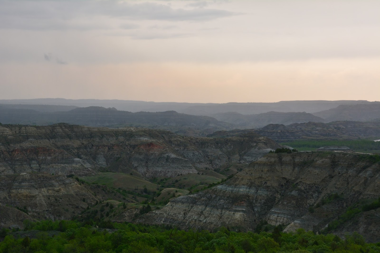
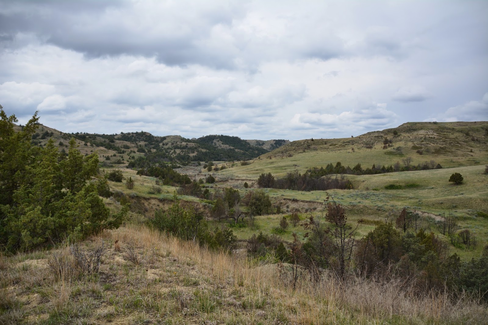
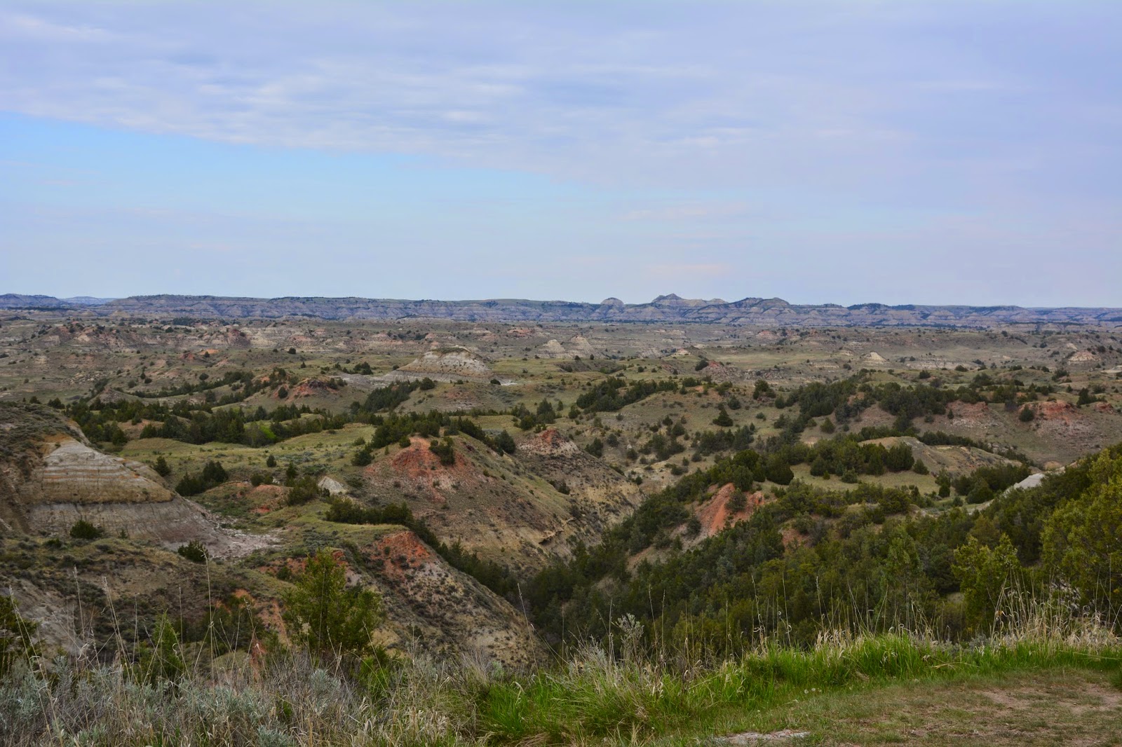
While we were in the area we drove over to the Little Missouri State Park which contains some the most rugged, picturesque Badlands terrain in the state. There we were, driving along the highway, and the oil fields, and all of a sudden the earth open up before us. Here are some pictures of what it looks like from inside the state park.

In this picture, and the ones below, you can see the thunderstorm and rain falling in the distance.


Tuesday, May 26, 2015

Out with the old

The North Dakota Badlands contain a wealth of fossil information that indicate that the park was once on the eastern edge of a flat, swampy area covered with rivers that fanned out into a broad, sea-level delta. This swampy region contained dense forests of sequoia, bald cypress, magnolia, and other water-loving trees growing in or near the shallow waters.

Some forests were buried by flood deposits or volcanic ash falls. When silica-rich water soaked into the trees, organic compounds in the wood were dissolved and replaced by very small crystals of quartz. This is petrification.

Theodore Roosevelt National Park has the third most important collection of petrified wood in North America - who knew?! Located in the portion of the park that is designated wilderness, the petrified wood is found along a 3.5 mile trail that covers some of the most spectacular scenery in the park.

We had to drive outside the park and through private property to reach the trailhead of the Petrified Forest Trail. The Petrified Forest Trail is 3.5 miles into the center of the park's wilderness area where  it meets the Maah Daah Hey Trail ( a 96 mile trail that traverses the rugged Little Missouri Badlands between Sully Creek State Park near the South Unit and ends in the North Unit.). 

There they are, along the side of the trail - prickly pear!

The first mile of the trail was along a high ridge that afforded a view of the badlands.

The petrified wood is first seen about 1.5 miles from the beginning of the trail.

Pretty cool!

Another section of the trail along the high ridge.

At about 2 miles we came to this fantastic area with weird formations and more petrified wood.


That was some huge tree. The one in the background is...

this one close up.

Frederick is there for scale.

These stumps have eroded out of the hillsides ("out with the old") and march out along this valley - they are huge.

We passed by several of these bison "wallows" with tufts of hair in the dirt.

This trail sign-post could not withstand the rubbing of an itchy bison.

Deep into the wilderness area.

The trail along a high ridge.

Another section of fantastic shapes and petrified wood.

On the return trip everything always looks different, even though you are traveling the same trail. You see it from the opposite direction.

A really steep part of the trail.


Back at the Visitors Center we toured the museum where there was this wooded carving of Theodore Roosevelt.

The restored Maltese Cross cabin that Roosevelt used on his first ranch was a substantial, soundly built structure and was moved here, to the Visitor Center, from 7 miles south of Medora.

Monday, May 25, 2015

Jones Creek

Maybe its because it's the first time we are seeing Theodore Roosevelt National Park, except for a drive-by 15 -20 years ago on one of our cross-country drives to Coeur d'Alene, but we are amazed, and thoroughly enjoying,  the beauty of the landscape in the Park.

Today's introductory hike was the Jones Creek (how could we resist) Trail that bisects the scenic loop road and presents a cross-section of the terrain in the Southern Unit of the Park.

Trail markers along the way.

This is Jones Creek, a deeply eroded creek bed that is just about dried-up after the spring thaw and run-off.

More pictures from the trail -


After the hike we continued in the car along the scenic loop road.

Our next stop was at the Boicourt Overlook. From a high plateau we were able to look over the broken badlands. 

There was a short, 1/2 mile, trail that took us out on a promontory for one of the best views of the badlands in the park.


Another short nature trail is the Coal Vein Trail. From 1951 until early 1977 a fire burned here in a coal seam. The intense heat baked the adjacent clay and sand, greatly altering the appearance of the terrain and disturbing the vegetation. Burning coal veins have helped shape the badlands. Lightning, range fires or spontaneous combustion can ignite coal beds. As a coal seam burns away, the earth above slumps into space once occupied by the coal.

 Heat from the coal fire bakes the surrounding clay into natural, red, brick, locally called "scoria."

An old, twisted tree along the Coal Vein Trail.

A narrow coal seam.

Wild horses roam in the South Unit just as they did when Roosevelt rode over this land.

We are charmed by these bowl-shaped formations.


A little bit like a Devils Tower wannabe.

True scoria is volcanic in origin. Locally, where coal seams have caught fire and baked the surrounding sand and clay, the result - like a natural brick - is called scoria. Over the years erosion has removed the softer earth and left the bluffs capped with this harder, more resistant material.