Bourgeon Lake has been calling to us for two years, but because it is categorized as a "challenging" hike, we have been waiting for the right day to tackle the trail. But, since we are running out of days in Banff, and the forecast isn't perfect for any of the remaining days, we decided to go today and be prepared for any type of weather.

Of the numerous high lakes along the Bow Valley, Bourgeon is the nearest to the town of Banff, 8 miles, so we arrived at the trailhead at 10:30 a.m. and were only the second car in the parking area. In the picture above you can see the bathroom (washroom in Canada), the dumpster and right behind the dumpster is the gate through the fence, designed to protect wildlife, to the trail - just like yesterday.

After climbing through the forest for about 2.4 km (1.5 miles) we came around a switch-back and had this open view across to the other side of the Bow Valley and the serrated summits of the Sawbuck Range.

At 3.8 km, approximately 2 miles, we crossed Wolverine Creek, the outflow from Bourgeau Lake, on a wooden bridge.

Looking up-stream from the bridge and noticing all of the fallen trees. (Remember, you can click on any of the pictures to make them larger and see more detail.)

After another 2.5 km (at about 3.4 miles), and a 10 minute pause in the woods for a passing rain shower, we came to a crossing of the falls from the Lake Bourgeau out-flow. We thought maybe we only had to climb as high as the falls, but we were so wrong!

Fortunately there was this cleverly trail-engineered crossing at the creek crossing.

Small rocks are held together in these rectangular wire mesh cages. From here, for the next 3/4 miles, the trail ascends through a series of steep switchbacks and is probably the reason why the trail has a "strenuous" rating. There will be no pictures for the next 3/4 mile.

After the climb, the trail leveled out and we caught our breath and prepared to deal with the snow and the mud as we entered a long meadow before arriving at the lake.

As we were passing through the meadow we heard a distant roar and looked to the cliffs above us and saw an avalanche dumping snow and water down the side of the cliff. Again, if you click on the picture you can see three or four places where the avalanche is still pouring off the cliff side.

Finally, at the lake's rocky shore, we found the biggest rock and prepared to eat our lunch.

Pano of Bourgeau Lake, Mout Bourgeon and our lunch view.

And, Maura and Bill, here's our lunch buddy, Ms. or Mr. Chipmunk coming out of a crack in the big rock to join us for lunch;

check out our poles; and,

do a few stretching exercises.

Bourgeau Lake in its natural amphitheater, and our big lunch rock with Frederick descending the rock after lunch.

It wasn't easy getting down off the rock.
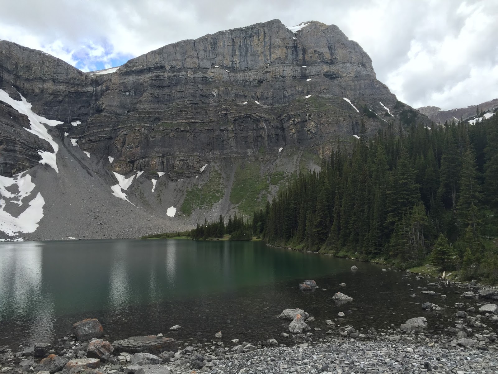
Mount Bourgeau towering over the lake.

Looking south from the lake and Mount Bourgeau, down the valley that we had ascended.

Apparently the open meadow is filled with an array of colorful wildflowers through late July and August. We saw quite a few (click on the picture) that were already anticipating the summer.

There were lots of these water-loving flowers next to the trail.

Frederick navigating the wet and marshy meadow and muddy trail.

Mountains all around us and surrounding the meadow.

As we passed these peaks we heard and saw more avalanches.

Slogging through the mud as snow still covers the trail.

Along the steep trail down (now we can take pictures) we got this filtered view of the out-flow stream that will become the falls that we will re-cross further down the trail.

Lovely high view across the Bow Valley.

I'm standing in the middle of the falls, on one of the rock cages, taking the picture straight up the falls.

The lower part of the trail back was really quite lovely with...

thickly covered moss hillsides, and...

moss-draped rocks.

We have begun to see some mushrooms;

some homes to burrowing ground squirrels; and...

more mushrooms.
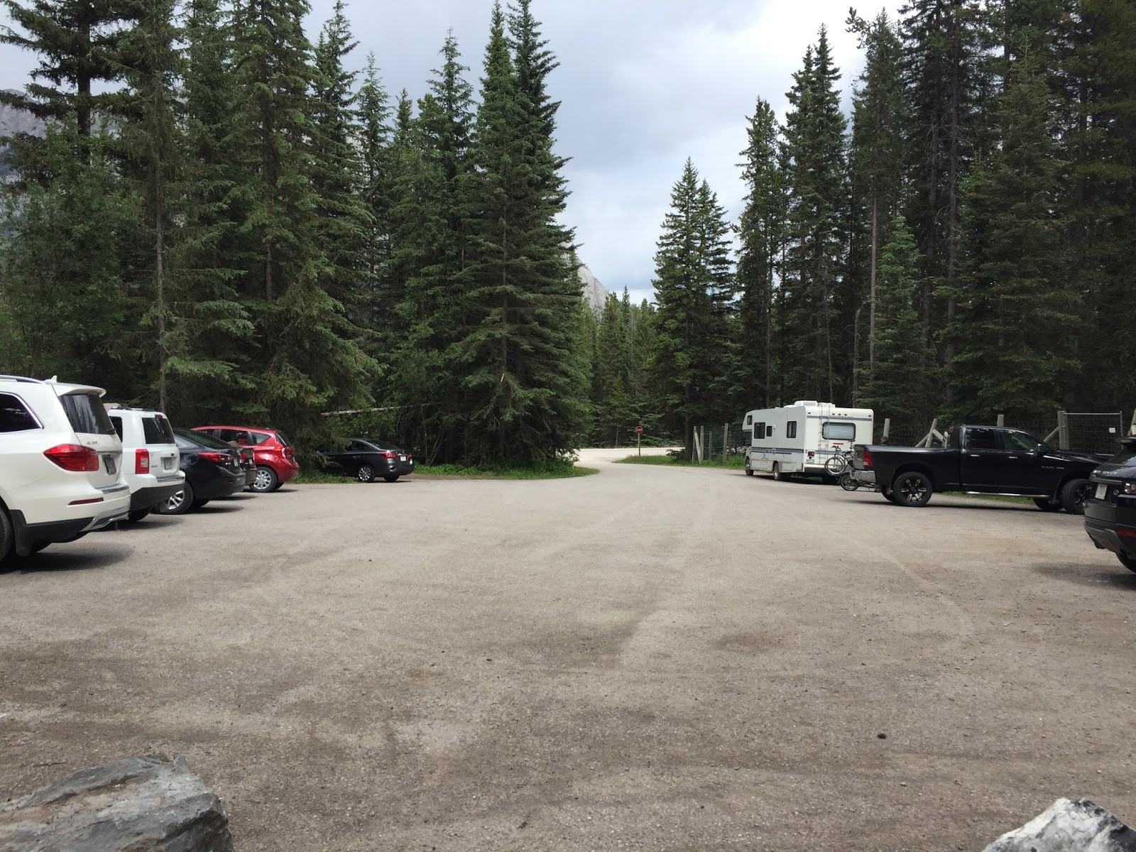
While we passed only one couple on the way up to the lake, while we were eating our lunch several other couples arrived and we also passed by a few more hikers on our way down. When we got back to the trailhead, we could see how they all arrived.
Today's hike:
Length - 9.77 miles
Duration - 5 hours, 23 minutes (including lunch and the rain storm pause)
Elevation gain - 2,490 feet (250 floors on the Fitbit)
Where are the tea houses? It is beautiful though, I can see why you still love Banff.
ReplyDeleteWow - absolutely gorgeous! What an incredible experience! Safe travels onward!
ReplyDelete