
Some of you know that riding a gondola is not my favorite, but Frederick promised to hold my hand and that everything would be all right. Who wouldn't feel comforted looking at that face!
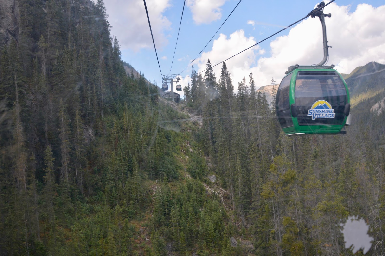
The trip up the mountain.

A look down at the road and hair-pin turns that the bus used to navigate to get us to the top.

Rock Isle Lake - another of those "most photographed spots in the Canadian Rockies".

Views of the Lake as we began our loop...

down through the wildflower meadows and...

the next two lakes.

Panoramic view of the Kooteneys above the meadows.
Some lovely wildflower meadows.


A creek winds it's way through the meadows and there are several cascades and small waterfalls.


Approaching Grizzly Lake.

A sentinel welcoming hikers to Grizzly Lake.

Between Grizzly and Larix Lakes is Simpson Viewpoint and the Simpson Valley beyond.

Next up is Laryx Lake (the Latin botanical name for alpine larch is Laryx lyallii), the larger of the two lakes. View of the Kootenays over the Lake.

After looping Grizzly and Laryx Lakes we began the climb up to Standish Viewpoint. Looking back down the trail we had magnificent view of the lakes we had just visited. That's Laryx Lake partially hidden by the trees and...

a little higher elevation gave us a clearer view of Laryx.

Rock Isle Lake
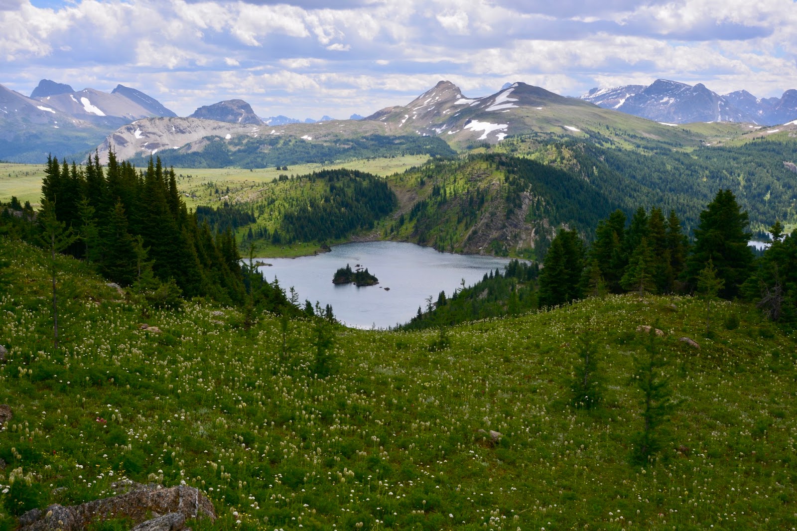
Rock Isle Lake once more and...

Rock Isle Lake on the left and Larix Lake on the right.

At the top of Standish Viewpoint there is a marker for the Continental Divide and the border of Alberta and British Columbia Provinces. There's Frederick standing with one foot in Alberta and the other in British Columbia. By now the weather had started to deteriorate and the temperature dropped (to the upper 40's) and the wind began to blow.

It is possible to get off the gondola in Sunshine Village and take a chair lift to the top of Standish Viewpoint. It's a way to avoid most of the serious climbing so, of course, we didn't want to do that! Why else would we hike?!

It was too cold and windy to eat our lunch on Standish Viewpoint so we came down a found a bench at an overview of the Standish Valley.

Lunch view - Laryx to the left and Grizzly to the right.

After lunch, as we were passing through Twin Cairns-Meadow Park on our way down, we could see the smoke from the wildfire just over the ridge in Kootenay and the western edge of Banff. Parts of Kootenay have been closed, but, so far, Banff's occupied areas are only affected by the smoke and ash. This morning I had to clean up ash that had come through the windows into the Airstream. We're afraid that the wind that is blowing fiercely will exacerbate the fire. We're glad to be moving on to Jasper tomorrow.

Trip down the mountain from Sunshine Village to the parking lot.
Today's hike:
Length - 8.12 miles (12.76km)
Duration - 4 hours, 10 minutes (including lunch)
Elevation gain - 1,725 feet (488 meters)
No comments:
Post a Comment