
There are dramatic waterfalls throughout the canyon. This one, at Third Bridge, and...
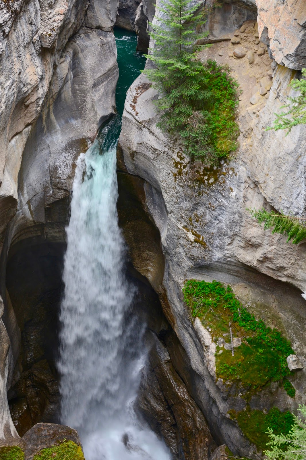
this one at Second Bridge are the most dramatic.

At First Bridge there is a large parking area and a cafe-gift shop where we ate our lunch on a bench outside. During lunch we met a nice couple from Edmonton, and their dog Gypsy, and we asked them for tips about Edmonton. They enjoy cross-country skiing and like living in Edmonton in the winter.

Much more water flows beneath Sixth Bridge than flows over the falls in the canyon. That is because the Maligne River is fed by a network of catacombs through which water flows into the River along its sides. In the picture above, the River is flowing from the left and in the center, quite a bit of water is flowing into the River along its bank.

Here's another confluence. The River is flowing from the bottom left and more water is rushing into it from a cave-like opening in the center of the picture.

Sometimes the water flows into the River from above and creates a beautiful waterfall.
Today's hike:
Length - 5.25 miles (8.48 km)
Duration - 3 hours, 30 minutes (including lunch)
Elevation gain - 622 feet (180 meters)
No comments:
Post a Comment