As I've mentioned before, most hikes start uphill and finished downhill, but this one started on the rim of the Grand Canyon of the Yellowstone and dropped to the river below. Hikers sometimes refer to this trail as Seven Mile Hole because it feels like 5 miles down and 7 miles up; it is rated as difficult and strenuous. Actually, and officially, it's named for the distance below Lower Falls, about 7 miles downstream.

The trail began on the left side of Glacial Boulder (we took this picture at the end of the hike when the sun was shining and the sky was blue), a 500-ton granite boulder left behind 15,000 years ago during the last ice age. It was plucked from mountains at least 40 miles away.

The trail closely followed the canyon rim for over a mile with excellent views into the canyon just a few yards from the trail.

While we travelled along the canyon rim, the fog began to burn off and we were able to see the river 1,500 feet below.

Just before we began the descent into the canyon, the sun came out and...

we could see thermal features along the river's edge.

On the way down we passed a dormant geyser.

As we continued to drop down we passed a sulfur thermal area - you might be able to see the blue hot pool on the right and the bubbling hot spring just to the left of the middle of the picture.
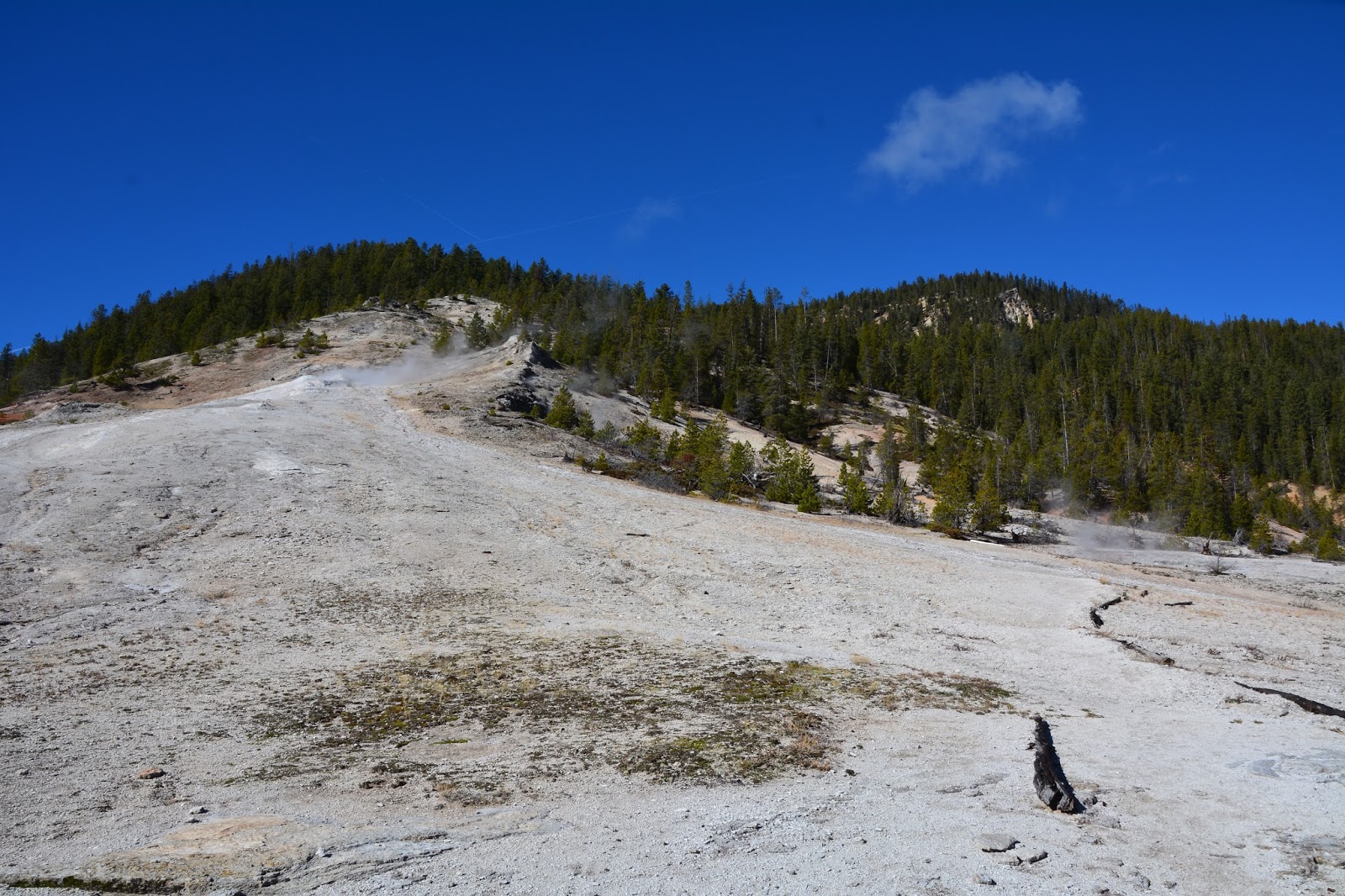
Looking back up the hill we could see that the thermal features are mere remnants of the once extensive hot springs activity that covered this area.

After dropping about 1,400 feet in 1.5 miles we reached our lunch spot beside the mighty river rushing by.

Our lunch views across the canyon...

looking downstream and...

upstream. Notice the thermal features steaming from the sides of the canyon.

Our lunch spot was next to Sulpher Creek which cascades down the side of the mountain and...
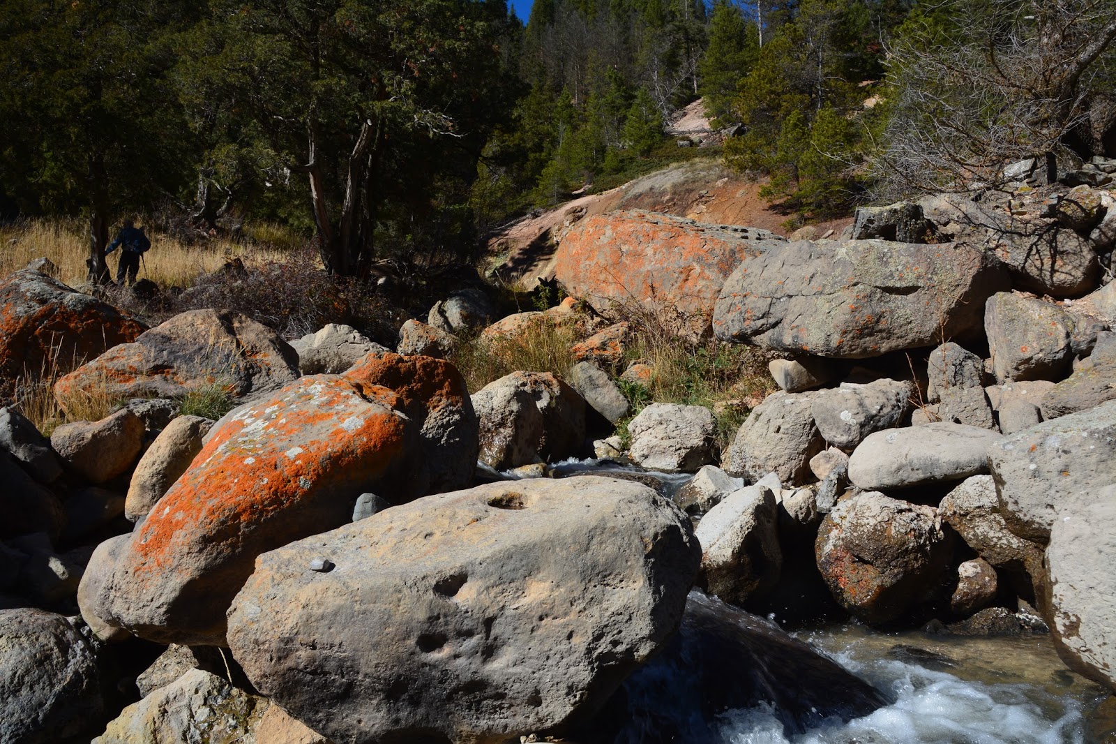
empties into the Yellowstone River next to where we were sitting. See Frederick in the trees on the left?

As we started our climb out of the canyon we had this view upstream of very interesting and colorful canyon wall features.

Part way up we had this view of a waterfall.

We made it up and out and on the trail back we passed a meadow where we had this view of Mount Washburn and the weather station we hiked to last week. When we passed by this view in the morning there was snow half-way down the sides of both peaks. By 4 p.m. this afternoon, there was just this dusting on the top. I guess the sun is very hot at this elevation - 10,000 feet. It is a good thing that we hiked Mt. Washburn when we did because the road to the trailhead is now closed for the winter.

1.5 miles from the end of the trail, with the fog gone, we could now see Silver Cord Cascade visible on the south side of the canyon.

Its 1,200-foot drop makes it the highest cascade in the park.
Almost back to the trailhead and the granite boulder, we passed several overlooks into the canyon that showed impressive canyon-wall formations.


Once back, we drove to Inspiration Point, about 1/4 mile down the road and had this view upriver of the Lower Falls and...

down the canyon . Where we hiked down to the river is probably somewhere in the trees on the left side of the river.
Hike statistics:
Length - 10.62 miles
Elevation gain/loss - 1,350 feet ( 246 floors, 2,400 feet, on the Fitbit)
Duration - 5 hours, 52 minutes
Do you really want to eat your lunch near the sulfur springs? I remember them being odorous.
ReplyDeleteFor some reason this cascade didn't have an odor. Maybe the wind was blowing it away from us.
DeleteLovely to see Frederick bonding with the trees. Hugging is good, right?
ReplyDelete