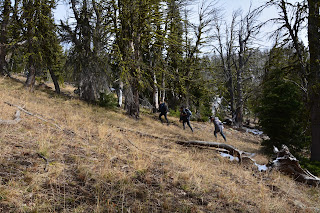
The trail began through a forested valley with Black Butte dominating the scenery.
We passed through stands of whitebark pine that have suffered a high mortality rate caused by the mountain pine beetle. This increased mortality appears to be caused by the beetles' ability to move into high altitude areas, and into stands of the pine that were previously out of reach of the pine beetle before the recent warming trend. Scientists believe that the milder winters, with earlier snowmelt, are decreasing the over-winter mortality of the beetles.
Crossing one of the high meadows we looked back and began to see the mountain ranges that surround the area.
Looking up the meadow slope, we noticed these strange, conical-shaped out-crops that...
appear to be volcanic. We'll have to do more research on these because we have not seen anything describing them or how they are formed.
About 5 miles into the hike, the trail left the meadows and forest and emerged onto a sparsely treed ridge the provided some views back into the central portion of Yellowstone Park and the surrounding mountain ridges.
I think that we are lucky that we had precipitation a few days ago because there is now snow on the mountain peaks.
We made it to the summit of Bighorn Peak, 9,930 feet. There were spectacular views in all directions.
Please click on these pictures to see the enlarged version.
Bighorn Peak and adjoining ridge form part of the northern boundary of Yellowstone National Park.
Off to the east was a valley that had some intriguing wall formations.
We only stayed at the top long enough to take pictures and then we headed back down. The temperature was in the lower 30s and with the wind blowing, it was cold.
We headed back to the shelter of the trees and...
there we enjoyed our lunch. Yes, that is snow just behind Frederick.
Our lunch view.
Generally when we have been out hiking this past week we have seen very few people. Not today. We passed two groups of hikers on the way up, and while we were eating our lunch they caught up with us on their way to the top of the peak. Here the first two members of a six person group are running up a very steep portion of the trail.
And here are some of their group trudging past. We were able to tell them they only had about 0.5 km to go.
When this group of six women came past they stopped to visit with us. They are from the Big Sky Resort area about 20 miles down the road. They were going out on an overnight trip.
They were from many different states and were having a great time together. We talked with them about their favorite trails in the area.
Starting back to the trailhead after lunch, 6 miles away.
At the trailhead we met this merry group of hikers. They are a group of retirees who engage in monthly outdoor activities - hiking, biking, snowshoeing, etc. From Idaho Falls, Idaho, they formed as an outshoot of Elderhostel and another senior learning group. Their group is called Friends for Learning. Meet, from the right, Garney, Sondra, Chris, Nancy, Paul, Dawn and Jim (the organizer). They were just finishing their hike and were headed for waiting juicy hamburgers and French fries.
Hike Statistics:
Length - 12.49 miles
Elevation gain - 3,117 feet (336 floors on the Fitbit)
Duration - 6 hours, 12 minutes


No comments:
Post a Comment