The Menan Buttes are extinct volcanoes formed by violent eruptions 10,000 years ago - near the end of the last ice age. They are unusual because they erupted through the cold waters of the Snake River that flowed where the buttes stand today. When molten magma met the cold river water it cooled so quickly crystals were unable to form and the lava solidified into glass called tachylite. The heat of the magma turned the river water to steam, shattering the magma into tiny fragments that welded together as the hot ash settled to the ground into glassy rocks.

This picture from an exhibit at the base of the trail leading to the rim of the volcano shows the column of molten rock coming into contact with the cold Snake River. The instant chilling explosively turned the 2,000-degree-Fahrenheit magma in the column into minute fragments (ash sized) of Tachylyte, a type of volcanic glass. As these shards fell back to Earth, forming twin cinder cones, they fused together as a rock called tuff.
Frederick took the following 4 pictures on the drive over to visit the twin buttes in Idaho. Where we are, in West Yellowstone, MT, it is possible to drive from Wyoming, across Montana and into Idaho in the distance of 15 miles.


Frederick liked these nice...

cloud formations.

Ten miles southwest of Rexburg, ID, are the Menan Buttes - a unique, textbook pair of "glass" volcanoes, the largest of their kind. They are found in only a few places in the world.

The three of us climbed up the side of North Menan Butte, a National Natural Landmark, because the buttes are the only volcanoes in the U.S. to erupt through freshwater.

A view into the interior of the 5,800-foot-diameter (at its base) butte crater.

While Mr. Spock poked around under a nearby tree, Frederick and I took off on the trail that circles the 3,000-foot-diameter crater rim.
The first section, about a quarter of the way around, was made up of dark-toned lava beds with tuff of weird and fantastic shapes.


Frederick is there for scale. It appeared to me to be a bit of a moon-scape.

About a quarter of the way around we had a view out toward the St. Anthony Sand Dunes, largest set of sand dunes in Idaho.

Covering 175 square miles, they are approximately 35 miles long and 5 miles wide and 50 to 400 feet tall. The sand is made up mostly of white quart peppered with black basalt.

A little further along we had this view of the Snake River.

Half-way around we had this view of South Menan Butte.

More weird rock formations.

There were sections of the trail that disappeared completely and we had to find our way around the rim. Here we have wandered into a sort of box canyon and had to retrace our steps.

These weird rock formations are caused by wind erosion.

The highest point on the crater rim was 3/4 of the way around. Here Frederick is standing on the very highest point and, of course, the wind is blowing about 120 mph!
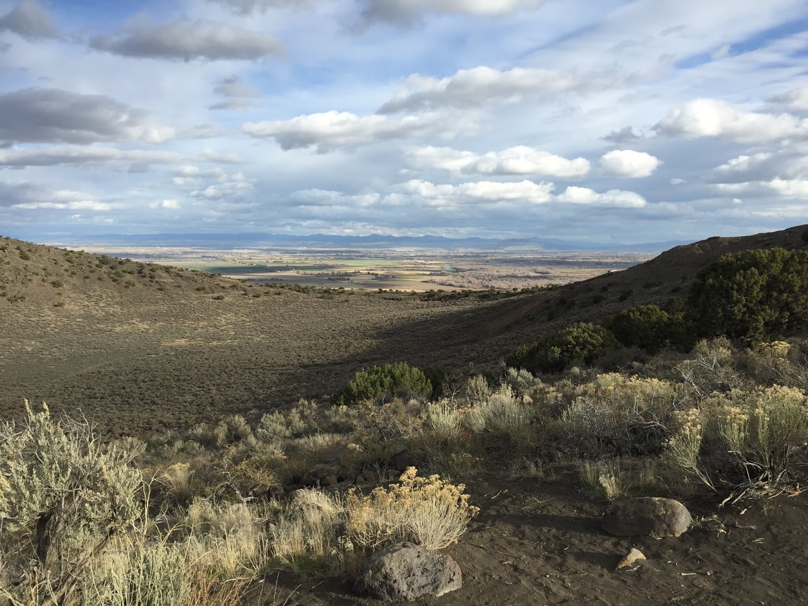
A view across the crater through a low point that reveals the sage-brush expanse of southern Idaho.

This is also the agricultural heartland of Idaho - particularly potatoes.

On the way back to West Yellowstone, Frederick captured this picture of the back side of the Grand Teton Mountains.
Hike statistics:
Length - 4.24 miles
Elevation gain - 1,260 feet (128 floors on the Fitbit)
Duration - 2 hours, 45 minutes
Exquisite sand dunes!
ReplyDelete