By the time we finished our business and were ready to hit the trail it was almost 3 p.m., but I'm glad we persevered because it was a good trail and a wonderful hike. Thank goodness for Daylight Savings Time!

We traveled up into the Sandia Mountains east of ABQ. Here we've climbed up the side of a canyon and have an overview of the plain at the base of the mountains that contains ABQ and environs.

The Sandia Mountains remind me of...

the Sierras in California.

Particularly this small peak that looks a bit like Half Dome in Yosemite.

A view of ABQ at a lower elevation.

Since it was late when we started we hiked the time. Out for 2 miles or 1 hour, which comes first (or last, depending on how we're feeling).

This was our turn around spot which, when we looked at the map when we got back, was almost to the end of the Piedra Lisa Trail.
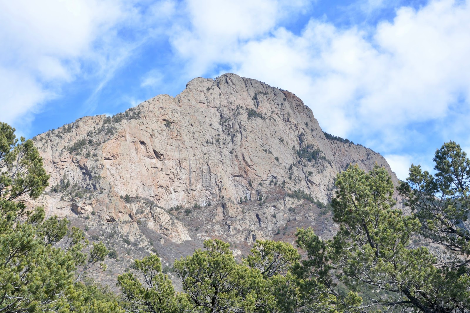
Here's another view of the mountain that reminds me of Half Dome.

Another view of the valley with mountains rising from the floor.

Can you tell I liked this mountain?

This picture shows Frederick descending the trail. But you can see that there were trees and the trail was well groomed.

Just at the trailhead, at the base of the canyon, there is the Evergreen Hills Subdivision with some pretty spectacular houses. (hint: enlarge)
Today's hike:
Length - 4.15 miles
Duration - 2 hours, 13 minutes
Elevation gain - 1240 feet (123 floors on the Fitbit)
So I was on the computer when I got your nightly link for the blog, what a difference from my phone. Amazing pictures, Mom.
ReplyDeleteHow are you feeling, Dale?
ReplyDeleteGreat ! Both of us are doing well!
DeleteGreat hiking place. Do they still have the tram that takes you from the valley to the top of the mountain where there is a restaurant that overlooks the valley and is super for a twilight repast--somewhat scenic perhaps.
ReplyDeleteYes, in fact, the trailhead for this hike is off Tramway Road. We didn't take the tram up the mountain.
Delete