Between the end of June, yesterday and today, we have travelled 25% of the trails in Kootenay National Park, there being only 125 miles of hiking trails in the whole park. Many of trails show the effects of a lightning caused, devastating forest fire in 2003 that burned 12.6 % of the park. We first experienced the impact of the fire when we took the guided hike to the Burgess Shale along the Stanley Glacier trail in late June with Peter and Vian. Most of the forest in the Floe Creek valley, today's hike, burned in the 2003 fire.
It was a little like walking through a dwarf forest with the silver-grey trunks of the burned forest towering over the new growth.
The trail descends to cross the Vermilion River.
The river's name, Vermilion, refers to the red stains of iron oxides found along its banks, upstream. We followed this beautiful, blue-green river 1 mile before we reached the narrow valley of Floe Creek.
Floe Creek Valley is narrow with many run-off streams down the steep sides. This one was choked with logs.
Three miles along the trail, when it was time for a snack, usually a protein bar, we came across this "bench" that someone had constructed beside the trail, complete with a Christmas tree. We sat right down and enjoyed a bar and the view.
This was the view.
The trail was a steady climb through the valley until the 3.4 mile mark when we began a series of switchbacks up the side of Numa Mountain - 1,312 feet in 2 miles - a tough climb. Here is the reward.
Floe Lake, with glaciers at the base of the cliff, to the south,...
straight across the lake, west, and...
to the north.
Floe Lake occupies an inspiring setting at the base of the Rockwall, a cliff that extends 33 miles through western Kootenay and southwestern Yoho national parks. In places this rampart is almost 3,000 feet high. Up close, the rock looks like zebra stripes - alternating layers of darkish limestone and paler dolomite.
We ate our lunch on the beach, sitting on a zebra striped rock, with this as our view to the north and...
to the south.
These ducks, with elegant heads and necks, swam back and forth in the clear, blue water.
A closer view of the Rockwall with its striped rock.
We first met Gisele and Eder (a Basque name pronounced Edth -er), from Barcelona, along the trail - Gisele with her boot off and both of them trying to protect her heel from a forming blister. We offered mole-skin, scissors and tape from our First Aid kit and showed them how to apply it. We left them with the supplies and asked them to return the scissors to us when they reached the lake.
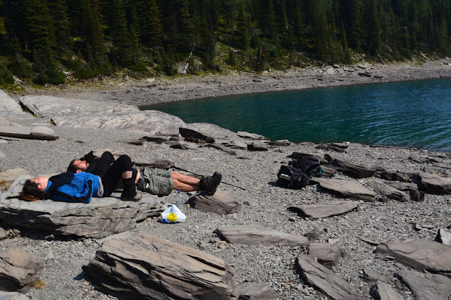
Here are Gisele and Eder enjoying the sunshine at the beautiful lake.
There is a back-country campground at the lake and these bear-proof food lockers are provided.
Both at the lake, and especially on the way back down the valley, we noticed that the sky was hazy and I'm sorry that the pictures are not clearer. The camera seems to pick up the haze and the pictures are not sharp. We're not sure why there was so much haze; someone suggested that it is from forest fires in the region.
Floe Creek occupies a steeply walled, V-shaped valley, sculpted more by the effects of erosion from flowing water than by moving ice. The steep slopes become natural paths for snow avalanches. Avalanche slopes comprise almost half the area along Floe Creek.
I have a confession to make. When we passed through the valley in the morning, the air was a lot clearer but I had decided to take pictures on the way down, our usual approach. Maybe I should learn from today and take a clear picture when I have the opportunity.
Trail statistics:
Distance: 14 miles
Elevation gain: 2,346 feet; 326 floors on the Fitbit
Time: 7.5 hours (including lunch & pictures)


No comments:
Post a Comment