We spent four glorious hours on the Fundy Trail today, a 10 mile, low-speed drive along the rugged Bay of Fundy coast which has the highest tides in the world. The Fundy Trail is a work in progress; the length will eventually extend to the Fundy National Park - it is about 1/3 complete.
It was very foggy this morning and we thought we would not have a chance to get on the Trail, but about noon it started to lighten up and by 1 o'clock the sun was out with blue sky, although there was still fog, in spots, along the coast.

The Village of St. Martins is really quaint, but in a real way - authentic. There are two covered bridges in the Village. We went through this one on our way to the Trail, which is about 4 miles from our campground.

In the harbor were these four boats. Notice on they are on solid ground. Check near the bottom of the blog for the four hour difference.

The first viewpoint on the trail was called Fox Rock Overlook. Not much to see except fog. But wait....

The second stop was a short, but steep, little hike to an overlook and a glimpse of one of the "Flowerpots" along the coast of the Bay of Fundy. The "Flowerpot" is the pillar with a couple of fir trees in the bottom right of the picture above. Notice the beach and the dry land around the "Pot". (On the northwest Pacific Coast they are called "sea stacks".

This is Melvin Beach. There is a trail that takes you down to the beach but we didn't take it. The beach looks almost manufactured by Public Works Canada.

The walk down to Fuller Falls is partly on these cable steps. The boards are strung on two lines of cable. It is almost like a wooden ladder on cables.

This is the top of Fuller Falls; it cascades quite a bit further down the hillside.

All along the trails and by the side of the roads are fields of wildflowers. The forested areas smell of pine and the side of the road smells of clover.

Another beach, Pangburn Beach. Doesn't it look like they brought in trucks of gravel? The tide is low; when it is high, the water comes up to the tree line.

By the side of one of the hiking trails was an observation deck - on one side we could see Melvin Beach, on the other side Pangburn Beach. This is a Bay of Fundy Trail work crew - Brett, Chris, Sam and Zach. Their shovels and tree loopers aren't in the picture. They were taking their break and were very friendly.

Black Point Lookout. At first we couldn't see any shore, but we were patient, and periodically the wind would blow the fog so we could see the outline.

The Trail has "comfort" stations at many of the stops. This is the Ladies and Men's toilet.

The Parkway Interpretive Center is about 2/3 of the way to the end. On a table was this lovely acknowledgment of the day - the 4th of July. In the frame it reads - "Happy Independence Day - American Neighbors and Friends". Very nice!

The Interpretive Center is located beside the Big Salmon River. Down a short trail is a suspension bridge with this caution.

We are about to enter the suspension bridge - just the two of us. We were careful not to walk in unison.

The Big Salmon River from the center of the bridge.

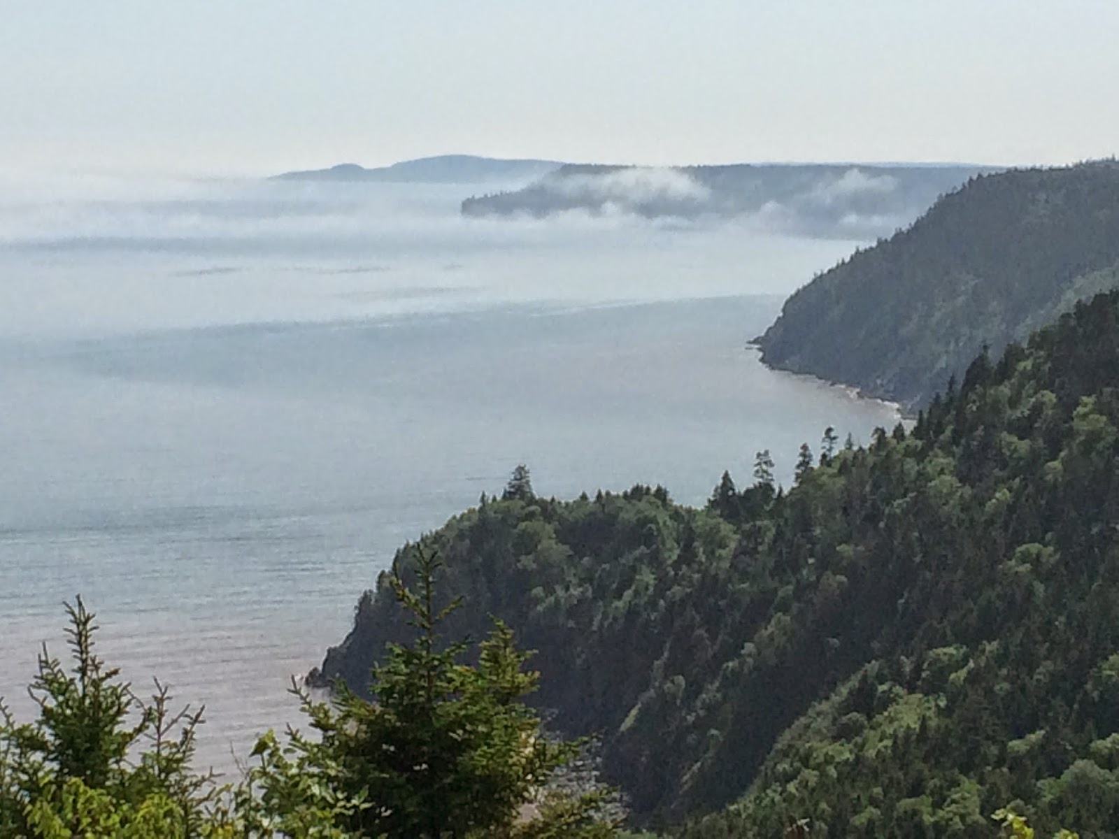
Towards the end of the Trail was this overlook from which we could see Nova Scotia. It is the darker blue line just above the fog and below those clouds. By now it is almost 3:30 and the fog is almost all gone.
Since the Trail is not complete, when you get to the end you have to turn around and drive back the way you came in. That was great because when we stopped at many of the places coming in we couldn't see because of the fog. For instance, this is Black Point Overlook which we could barely see on the way in.

There are some pretty steep, but short, stretches of road. Usually a 6 - 8% grade will be noted.

Here is the view of the Flowerpot on the return trip. Now the tide is in, the beach has disappeared and the Flowerpot is surrounded by water.

And this is the view from Fox Rock which was all fog in the picture above.
In yesterday's blog I had long-distance pictures of the caves across the little bay. These are the caves up-close, right on the edge of the Village just past the covered bridge. When the tide is low, you can walk right into these caves.

St. Martin's caves. Just to the right in this picture is a restaurant, The Caves. They list all the rewards they have received for their clam chowder on a sign out front. We received a 10% off coupon when we checked into the campground. Tonight we went for a cup/bowl of the best chowder I have ever eaten and wonderful lobster roll and coleslaw. Much better than what we had in Maine, which was good.

These are the four boats from the second picture above. I am taking the picture into the sun so it is not very sharp.
It is now about 10:00pm and calm outside, except for a heavy fog. It was a beautiful, sunny, blue-sky day. Now we wait for Arthur.
Looks like the calm before the storm, beautiful scenery though. Please keep us updated about the storm, I worry.
ReplyDelete