The weather the past week has been relatively mild, despite the wind, and the forecast for today was for clear skies all day, so we got up early, drove the 20 miles up to Siyeh Bend, parked, and headed for Piegan Pass at 9:45 am. - we couldn't have asked for a better hiking day!

At 2.5 miles, the Siyeh Pass Trail heads west and we continued north having Piegan Mountain, Piegan Glacier, and Mt. Pollock dominating our view to the left. Note the clear blue sky! Yeah!!

Shortly we began to ascend onto the barren talus slopes of Cataract Mountain.

There's the trail (center right) crossing the slope to Peigan Pass and the rarely seen view of the eastern side of the Garden Wall looms in the background. The tall peak on the Garden Wall is called the Bishop's Cap.

From the trail on the slope we could look down the St. Mary Valley and...

with the telephoto lens, see Siyeh Bend on the Going-to-the-Sun Road and our car parked on the right side of the road.

Who can identify this bird, perched on a alpine spruce along the side of the trail? Howard?

And just a little further along, this cute pika came out to see us pass. See him - just a little below the center of the picture.

Crossing the slope with the pass at center left.

One more look down the St. Mary Valley.

Arriving at the high col of Piegan Pass - that's the Garden Wall in the background.

At the top of the pass looking for...

a lunch spot that we found in this rock shelter that someone had built to protect visitors from the wind and...

to provide a home for the chipmunk (center of the picture). Every day, no matter where we eat our lunch, there is a chipmunk that comes around looking for its lunch. There was one at Ptarmigan Tunnel yesterday, Iceberg Lake on Saturday - I think it lives in our backpacks and comes out for lunch.

Frederick having a heart-to-heart with the chipmunk, telling it that "no, we cannot give you food because if we do, you'll starve over the winter."

After lunch we started down the other side of the pass and, to our relief, what you see in this picture is the extent of the snow on the trail.

Garden Wall from the pass with an un-named lake at the base.

The trail descended steeply with incredible views all around.

Garden Wall

The trail cutting across the north side of Cataract Mountain with a view down to the Many Glaciers area.

More trail shots as we descend.

Down the valley.

The Garden Wall from lower on the trail with the peacock-blue lake at the base.

The trail descended steeply to a high bench with subalpine fir parklands and...

one waterfall after another coming into view.

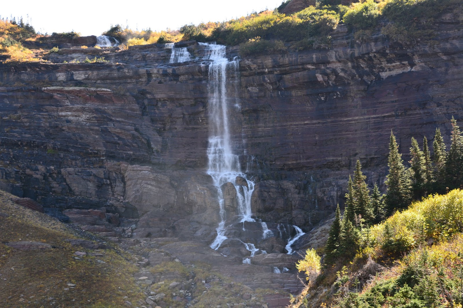
About a quarter of a mile from the bench, the trail draws even with Morning Eagle Falls.

The jagged peaks of the Garden Wall on the left and Mt. Grinnell rising from the valley floor on the right.

Passing through more subalpine fir.

Morning Eagle Falls

Coming closer to the falls until...
we reach the bottom of the valley at the base of Morning Eagle Falls.

The trail continued down the valley towards Many Glaciers Hotel with Mt. Grinnell on the left.

Three billy-goats gruff on the far side of the valley seen through the telephoto lens.

Across the valley you may be able to just make out the trail to Grinnell Glacier, a trial that we hiked on Friday, September 18.

We soon drew near Josephine Lake, about three miles from the hotel.

This wonderful man is Bill Kraemer from Kalispell. When we got to the Many Glacier Hotel road it was later than we had planned, about 5:15 pm. We got out our sign for Logan Pass and stuck out our thumbs. One of the first vehicles to pass was Bill in his truck. Because it looked like he had been doing some work in the park we weren't surprised when he passed us by. The next car was a woman who said she could take us to Babb if that would help. (We though it would be better if we tried to hitch-hike from inside the park, so we thanked her for her willingness to help.) Another car passed by but we could see that there was no room for passengers and the driver gave us a helpless look. There were few cars on the road at this time when we noticed that the white pick-up that first passed us was retuning on the other side of the road. Bill pulled over and asked us if our car was at Logan Pass and that he could drive us there. Thankfully, we got in and Bill, who turned out to be a geologist!, gave us a very pleasant 40 mile drive to our car up near Logan Pass. Thanks for the good deed, Bill.
Hike statistics:
Length - 13.8 miles
Elevation gain - 1,670 feet/loss - 2,640 feet (235 floors on the Fitbit)
Duration - 6 hours, 30 minutes
No comments:
Post a Comment