Blog for May 28-
It’s called Historic Medora and was founded in 1883 by the Marquis de Mores, a wealthy, 24 year old French nobleman who planned to revolutionize the meatpacking industry by slaughtering cattle on the range rather than shipping the live animals to eastern slaughterhouses. His venture failed, but the town he named for his wife remains and was the central pass-through on the Great Western Trail.
Between 1874 and 1893, seven million head of cattle and horses went up the Great Western Trail from Texas through nine U.S. states into Canada. This trail lasted more years, carried more cattle, and was longer than any other cattle trail in the United States. Longhorns gathered around Matamoras, Mexico, and south Texas were trailed north through Texas, Oklahoma, Kansas, Nebraska, South Dakota, North Dakota and on into Canada.
The first trail herd to reach North Dakota left from Texas in 1884. A daring band of cowboys piloted a monster herd from the Rio Grande to the Little Missouri River. Until the decline of the trail’s use in the 1890’s, thousands of cattle continued to come up the trail to be treated to the rich prairie grasses on the endless plains. Along with cattle came cowboys out of Texas who established ranches and helped grow North Dakota’s western heritage which is still strong.
The North Dakota Cowboy Hall of Fame is located in Medora and pays tribute to Native Americans, Cowboys and Rodeo Riders.


This sculpture for the Cowboy Hall of Fame, by North Dakota sculptor Arnie Addict, pays tribute to the cowboy.

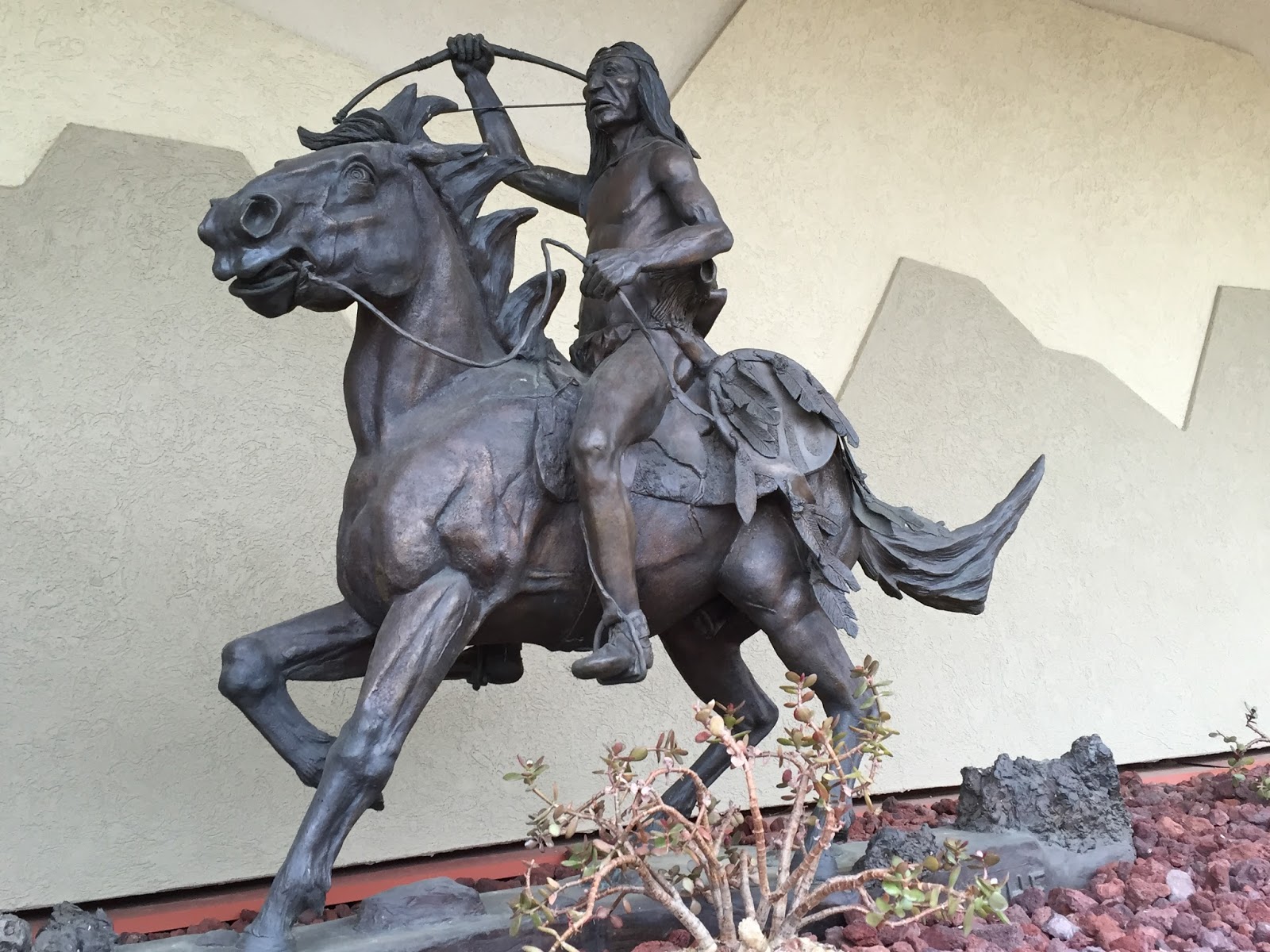
Another sculptor honors the Native American.

Notice the arrow in the side of the bison.

And in a garden next to the Hall of Fame is the Rodeo Rider.

Medora de Vallombrosa, wife of the Marquis de Mores, financed the construction of this brick church late in the summer of 1884. This gift to her namesake community was paid for from an annual income of $90,000 earned from a stock portfolio she received from her father before her marriage.

The cornerstone was inscribed with “Athenais”. Both Medora’s mother and daughter were named Athenais, but it was generally assumed by locals that Athenais refers to her infant daughter.

St. Mary’s Curch is the oldest Catholic Church still in use in the Bismarck Diocese. It is listed on the National Register of Historic Places.


The interior has been updated over the years, but the first four pews and the altar are from the 1884 building.

Throughout the town are great pieces of petrified wood from the Theodore Roosevelt National Park.

Lovely wind-sculptures in town.

This picture is for Bill to ruminate on.
Today we drove the 70 miles from the South Unit of the Park to the North. It is quite isolated and the campground in the park has neither water nor electricity. “Dry” camping will be a new experience for us.


These “Cannon Ball” concretions are formed within rocks by the deposition of minerals around a core, like a pearl in an oyster.

They may have any shape, but most are round.
Yesterday it rained quite a bit and the Ranger told us that the trails are pretty muddy. He recommended the Sperati Point Overlook trail as one that would not be too treacherous in the wet conditions.

A view down a canyon along the trail.

Prickly pear - yeah!


Sperati Point.

The end of the scenic drive (14 miles within the park) at Oxbow Overlook. The North Unit is all about the Little Missouri River which carved the badlands.


We watched a dozen bison taking their evening stroll.

One of the overlooks along the Scenic Drive described the small boulders. Geologists believe they were ripped from bedrock 400 miles north in Canada and carried to this point by a great glacier. The ice melted thousands of years ago but these rocks, called “erratics” because they are “out of place”, are clear evidence the glacier once covered the ground in the park.

Another overlook described the blue-black popcorn-like soil that caps a number of plateau that you can see in this picture and is called bentonitic clay. Bentonite clays “flows” when wet.

Today’s final picture is from the River Bend Overlook and shows the Little Missouri .
No comments:
Post a Comment