Peter Norbeck was the governor of South Dakota in the early 1900s and was enamored with western South Dakota. It was his conservationist vision that created Custer State Park in 1919. The Peter Norbeck Scenic Byway, and the Needles Highway segment, is arguably the most scenic of the byway. Peter Norbeck wanted to simultaneously preserve and provide access to some of the most beautiful regions of the Black Hills. In 1919, he designed the route for the Needles Highway, a road that many engineers deemed impossible to build. Two years and 150,000 pounds of dynamite later, the road was opened to automobiles.

Along the 14-mile highway there is the Hole-in-the-Wall picnic area. Here is Frederick beginning to explore the cave that is the Hole.

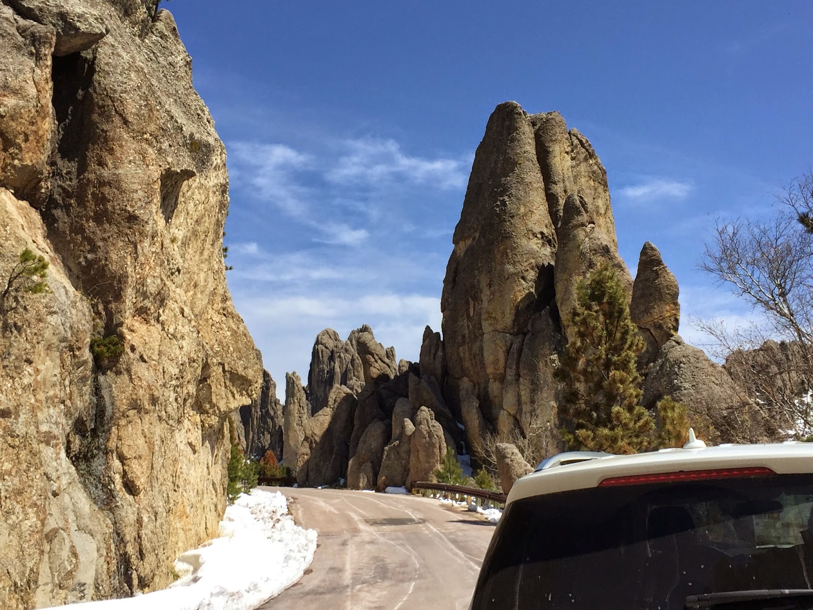
The road is named for the many towering, pointed rock columns that look like needles of rock piercing the sky. It winds through narrow tunnels and weaves its way through towering granite spires and ponderosa pine forests. Several turnouts along the way allow viewing of some spectacular formations.

Cathedral Spires from the distance.


We liked this spire that looks like it has a little top-knot balanced on the top.

There are several tunnels along the way. Tunnel #6 is the narrowest and lowest. There it is in the distance. (middle of the picture)

Last night Frederick checked the dimensions of the Benz to make sure we would be able to pass through tunnel #6. We make it with three inches to spare on each side.

Fortunately we are able to manually close the mirrors to the side of the car.

Looking back through tunnel #6.

Just through the tunnel there is the Eye of the Needle formation. The "Eye" is a narrow spire over 30 feet tall; time, wind, and water have eroded it to create a three-foot-wide slit in the top of the formation that looks like the eye of a sewing needle.
Shortly after the "Eye" we arrived at the trailhead of the Haney Peak Trail and discovered that it was impassible because of snow and ice. Time for a change of plans.

The Needles Highway ends at Sylvan Lake and there is a trail that circles the lake; that will have to do for our hike.

Frederick reenacting a scene from Lord of the Rings, trying to cross the Misty Mountains through a narrow passage.

Success!

Sylvan Lake is not a natural lake. It was created in the 1930s by the Civilian Conservation Corps. It is surrounded by towering granite peaks and ponderosa pine and is one of the jewels of the park.

Now, on to Mount Rushmore. But wait! The road is closed, with a locked gate. Spring has not yet arrived at this elevation to open the road.

We backtracked a bit and took another road to Mt. Rushmore, one that hosted some mountain goats.

There was one turn-out near the Monument that offered a view of George in profile.
The carvings were created in a three-step process. Workers first used dynamite to remove 400,000 tons of deeply weathered Harney Peak granite. Then, with hammer and chisel, they carved away an additional 3 to 6 feet of rock to prepare for the final step, during which pneumatic drills "bumped" the granite surface to the smoothness of sidewalk concrete and the artistic phase could begin.
Each year, silicone caulk is used to fill any micro fractures that develop in the faces, and in 2005 workers washed the faces for the very first time. At the rate this memorial is deteriorating, estimated at 1 inch every 10,000 years, it will be many years before these 60-feet-tall countenances require a cosmetic facelift.

Mr. Spock enjoying the Avenue of Flags which presents the 50 states in alphabetical order, listing their date of entry into the United States.

On the Grand View Terrace Mr. Spock could get a close-up view of the faces and...

imagine what it would look like if his face was carved in granite.

Selfie of Mr. Spock's companions.
On the way back to Custer State Park we drove a continuation of the Peter Norbeck Scenic Byway, the Iron Mountain Road. Peter Norbeck worked closely with Gutzon Borglum, the man who carved Mount Rushmore, to design Iron Mountain Road. The result of their combined efforts resulted in a road with several pigtail bridges and three tunnels, each of which frame the Mount Rushmore sculpture as you drive through them.

The iPhone camera just cannot capture the details of the carved faces as seen from a turn-out or...

the carvings framed by a tunnel.
Back in the state park we decided to take the Creekside Trail, 4 miles, beginning near the Peter Norbeck Visitor Center. There was only one parking space left at the Visitor Center - it was orientation for new park employees.

They appeared to be doing some type of scavenger hunt to find out about the park by reading and examining the exhibits in the VC.

It was a busy place with lots of activity and energy. We just went in and used the restroom.

Along the Creekside Trail which is at 4,250 feet elevation with much less snow.

A little bit like "Where's Waldo". Can you find the 4 deer?
No comments:
Post a Comment