Saturday, September 10, 2016

Misty Fjords National Monument and Salmon Glacier

Blog for September 8, 2016

Misty Fiords, maybe the prettiest name of all the national lands. However, to earn this name, the area has to be blessed with rainy, cool summers and heavy snowfall in the winter. Great for glaciers, and a visit to the Salmon Glacier was our highlight destination. The other attraction in Hyder is the Fish Creek Wildlife Observation Area where the U.S. Forest Service has constructed a viewing boardwalk along the Salmon River which allows viewers the opportunity to view bears, black and grizzly, as they fish for dog and pink salmon in the shallow Salmon Creek. We are a little late in the season and the Forest Service staff told us it was not a good day for bears, so we went right on to the glacier. 


There’s only one road gravel, washboarded and potholed, that climbs the mountains and that also provides transportation to gold mine operations along the road to the glacier.

Our quaint RV park in Hyder,...

Camp Run-A-Muck.

The U.S. Post Office. It, as opposed to the rest of Hyder, runs on Alaska time because it is a Federal Building.

There's barely enough room, at the base of the mountain, for the campground.

20 miles up the mountain from Hyder, and technically in British Columbia, is Salmon Glacier.

Salmon River flowing from the, toe of Salmon Glacier, flowing through the Coastal Mountains.

A little further along the road we spotted this jade-blue kettle pond along side the Salmon River. (Be sure to click on the picture to enlarge it. The blue-green kettle is amazing!)

Surrounding Coastal Mountains with more glaciers.

The Salmon Glacier is the fifth largest glacier in North America.


We drove up another 10 miles from the toe to see the glacier beginning to flow from the ice field.

Making the curve.


Driving back down we passed another hanging glacier.


The toe of the glacier.

At the toe of the glacier you can see a series of small ridge-like accumulations. These ridges are made up of Till that have deposited across the valley and are known as Terminal Moraines. 


At the toe of Salmon Glacier. If you look to the right you might see (especially if you enlarge the picture) the road cutting across the side of the mountain.


Deja Vu Backwards

Blog for Sept. 5, 2016

For most of today we were retracing our steps from Watson Lake, YT to Whitehorse, Yt, only in reverse so everything looked new. (See blog for July 20th)

 Early on, just outside Whitehorse, we ran into several patches of fog in the deep valleys between the mountains.
These mountains are mostly snow covered at the higher elevations.

Immense mountain; small Airstream.

As you can see, it was a beautiful driving day; temperatures in the upper 40s, lower 50s.

This mountain looks as if it could be in the southwest.

And, of course, fall foliage. That’s Fireweed at the bottom.

Cassiar Highway

Blog for September 6, 2016

We drove just a few miles in The Yukon this morning, actually, just one mile, before we turned off the Alaska Highway onto the Cassiar Highway and across the border into British Columbia. I think that’s “Goodbye” to the Yukon, just in time to beat the snow closings.

The Cassiar Highway travels through the Cassiar Mountains. There are lots of stories about the old days, driving the Cassiar Highway when it was a narrow, gravel road. Dramatically improved in recent years, it is still narrow with a chip/seal surface, although there was a good 50 - 60 mile stretch that had been paved in asphalt this year. 

This morning we were on work detail - we were de-parkers - which we did from 8 - 9 a.m. This was a special treat because usually de-parking is from 7 - 8 a.m. We were just lucky, I guess. Anyway, when we were sitting down to breakfast, Frederick looked out the window  and exclaimed and I immediately jumped up for the camera. Sunrises don’t last long!

Fall foliage in a fire damaged area along the early part of the Cassiar Highway.

71 miles along the route we stopped at Jade City, population 50. Jade City is not a city but a highway community made up of one jade business; Cassiar Mountain Jade Store. There are several major jade mines in the Cassiar region. The miners in the Cassiar Mountain Range produce about 1 million pounds of jade each year, and half of that is exported. 

Out in front of the gift store there’s a free jade-cutting demonstration. 

Approaching the Cassiar Mountain Range with…

cloud covered mountain peaks and rain.

Needlepoint Peak and fall foliage.

Our first look at Dease Lake which reminded me of Coeur d’Alene Lake, long and narrow. Maybe this is what Coeur d’Alene Lake looked like years ago before all the development.


One last time in Alaska

Blog for September 7, 2016

The Cassiar, Highway #37, is the western road south, from Tok, through Haines Junction to Dease Lake and eventually down to Prince George. But first, we took a spur road, Highway #37A, back west to an isolated Alaskan town, Hyder.

On the eastern fringe of Misty Fjords National Monument, at the head of Portland Canal, is Hyder (population 90). It is almost totally dependent on larger Stewart, BC (population 700), just across the Canadian border. Hyder’s residents use Canadian money, set their watches to Pacific time (not Alaska time), use Steward’s are code and send their children to Canadian schools. When there’s trouble, the Canadian Mounties ride in. We were able to drive across the border into the U.S. without stopping at a Custom’s Station. (We’re told that we will have to show our passports to get back into Canada.) We are at the frontier in Hyder, AK.

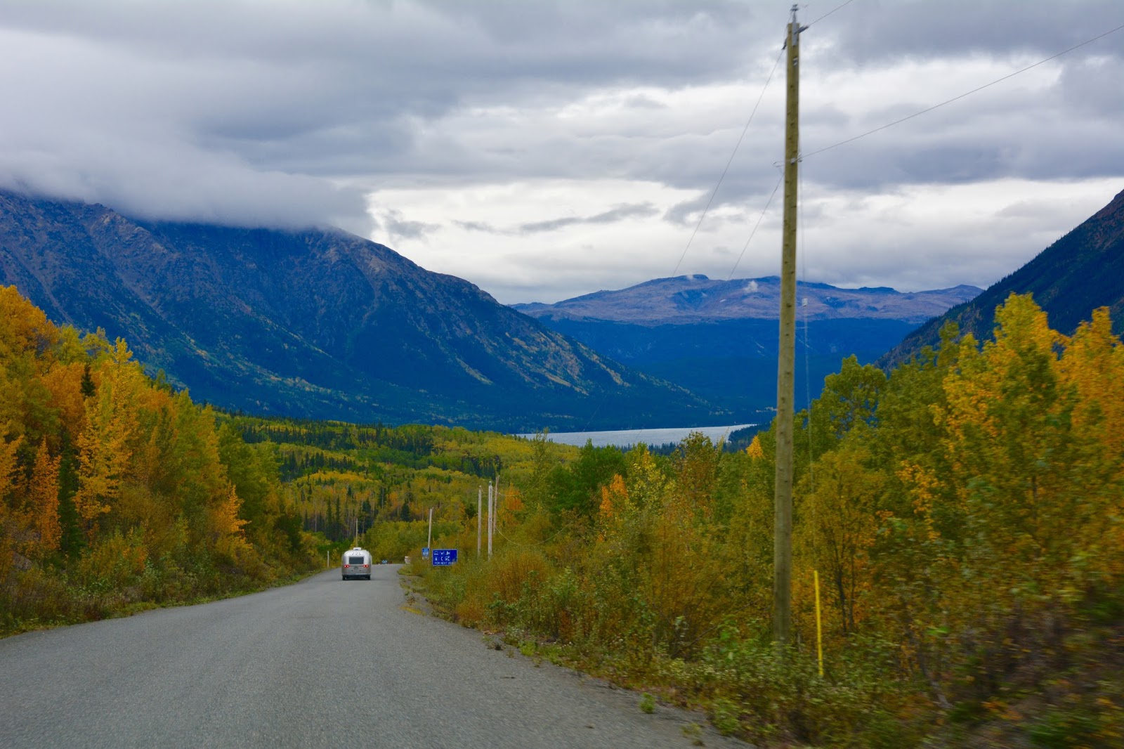
The drive, down the Cassair Highway to #37A, as usual, was spectacular and, as usual, it rained for much of the way.

To one side was Spatsizi Wilderness Provincial Park, and...

on the other side Mount Edziza Provincial Park.

The fall foliage is...

not as far advanced as it was in The Yukon.

Approaching the...

Skeena Mountains.


Traveling along the Bell-Irving River.

Approaching Mount Bell-Irving and the turn west to Hyder.

View of Bell Glacier, at mile15.2, along #37A.

At one time the glacier reached the other side of the highway. The old road is still visible hundreds of feet above the present road.

Entering...

Bear River Canyon with the Bear River rushing alongside the road.


Monday, September 5, 2016

Hoping

Today was our last "free" day in a large city - I never thought I'd consider Whitehorse, YT, population 23,000, a large city. There's a comprehensive supermarket in town - Canadian Superstore - and most of the Caravan paid it a visit today to stock-up on supplies, mostly fresh food. The next few days are going to be long driving days - one after another - through very small towns and out-of-the-way places. I don't think internet or grocery stores are going to be very good from here on out (Sept. 12 - end of Caravan ).

Campground in Whitehorse. Everyone is out and about getting stocked-up.

Some people observed the Northern Lights last night, about 11 p.m. We're hoping we can see them tonight, too. The sky is clear, so we have our fingers crossed.

Sunday, September 4, 2016

Drive back to Whitehorse

Today we drove about 250 miles from Haines to Whitehorse. Yes, we are back in The Yukon, slowly making our way back towards the lower forty-eight.
Haines as we left, in the morning light (7:30 a.m.).

A few pictures from Haines, Alaska, to Haines Junction, Yukon.


Back in The Yukon -


Kluane National Park ad Reserve of Canada. Superb fall color (except for red!).


Tonight we are back in Whitehorse, Yukon.

Saturday, September 3, 2016

Why we will miss the Caravan

Ever since we drove the Top of the World drive, from The Yukon to Chicken, Alaska, we have had a leaking fresh-water tank. We tried a number of fixes to no avail. Yesterday it was time to face the challenge head on.

Some of the repair committee discussing best steps and who has which tools to get the job done.

Tom, our lead mechanic, working his magic.

Frederick administering the finishing touches.

If something goes wrong, you never feel alone on the Caravan. As I said before, all a person needs to do is step outside, stand beside your Airstream with a tool, and you draw a crowd. We will certainly miss these good people!!