Blog for May 29-
The Caprock Coulee Trail begins as a 1.6 mile round trip nature trail with the option to add the Upper Coulee Trail to make it a 4.2 mile loop trail - which is what we did today. Our experience has been that trails advertised as having a self-guiding pamphlet, don’t. I think it’s a budget issue. However, today’s trail did provide the brochure, so come along with us as we take the Caprock Coulee Nature Trail. (We like these descriptive pamphlets because the more we know and understand what we are seeing, the more enjoyment and appreciation we have.)
The Caprock Coulee Nature Trail took us through one of many coulees found in the badlands. Coulees are long, steep, narrow valleys formed by water erosion which are usually dry except during infrequent thunderstorms, like the ones we had on Wednesday and Thursday, so the trail was wet and slippery in many spots.

Within ten minutes on the trail we met Kathryn and Matt who introduced themselves as community organizers. They had lots of facts and figures about the oil drilling and fracking, and ended our conversation by encouraging us to speak out against the oil drilling.

Here is an illustration of how rocks of varying hardness erode at different rates. The soft gray material is a mixture of sand and bentonite clay. The thin layers of rock are iron-impregnated sandstone which forms a protective shelf wherever it occurs.

Silvery-gray sagebrush grows profusely on terraces above the Little Missouri River.

The blue-grey sediment is bentonite which is chemically altered volcanic ash and clay that has tremendous absorbent qualities. It can absorb several times its volume in water and has many industrial uses. After heavy rains it expands and literally flows down hillsides.

Our pamphlet tells us that only a few species of cactus grow this far north. Hardy prickly pear is quite common in the badlands. The Plains Indians found many uses for it after they painstakingly removed the spines. They ate the fruits raw and stewed and roasted the large fleshy pads.

On the far hillside above the coulee are large light-colored pieces of petrified wood. The wood came from trees that grew here some 55 million years ago.

Also across the coulee is a small slump. Slump blocks are sheared from slopes but remain intact as they slide downward. We could match the colors of the layers in the slump with the hillside behind it.

These tunnels or vertical “pipes” in the coulee walls are formed by an erosional process called piping. Rainwater, funneling through small surface openings saturates ground sediments to the point of collapse, producing hollow, unstable cavities.

This tree is a green ash, found growing in ravines and coulees throughout the park. If you look closely you can see the bark on this tree has been rubbed smooth. Bison have been using this tree as scratching posts.

The bright-colored splashes on the tree trunks are masses of minute plants called lichens which consist of two different kinds of plants, fungus and alga, which live together in a closely balanced relationship.

Called the Caprock Coulee trail, these are caprocks in-the-making. Throughout the park are examples of rain pillars and caprocks. Harder than the sediments around them, the caprocks resist erosion. In so doing, they shelter the soft clays beneath them from the direct effects of rainfall. But the splash of raindrops, running water and wind eventually removes the surrounding material until mushroom-like pedestals or “rain pillars” are formed.
That was the end our the nature trail descriptions and we could have turned back, but we elected to continue on the Upper Coulee Trail.

After climbing up, and out of the coulee, we hiked along ridges for the rest of the way back to the car.
Panoramic views along the way.


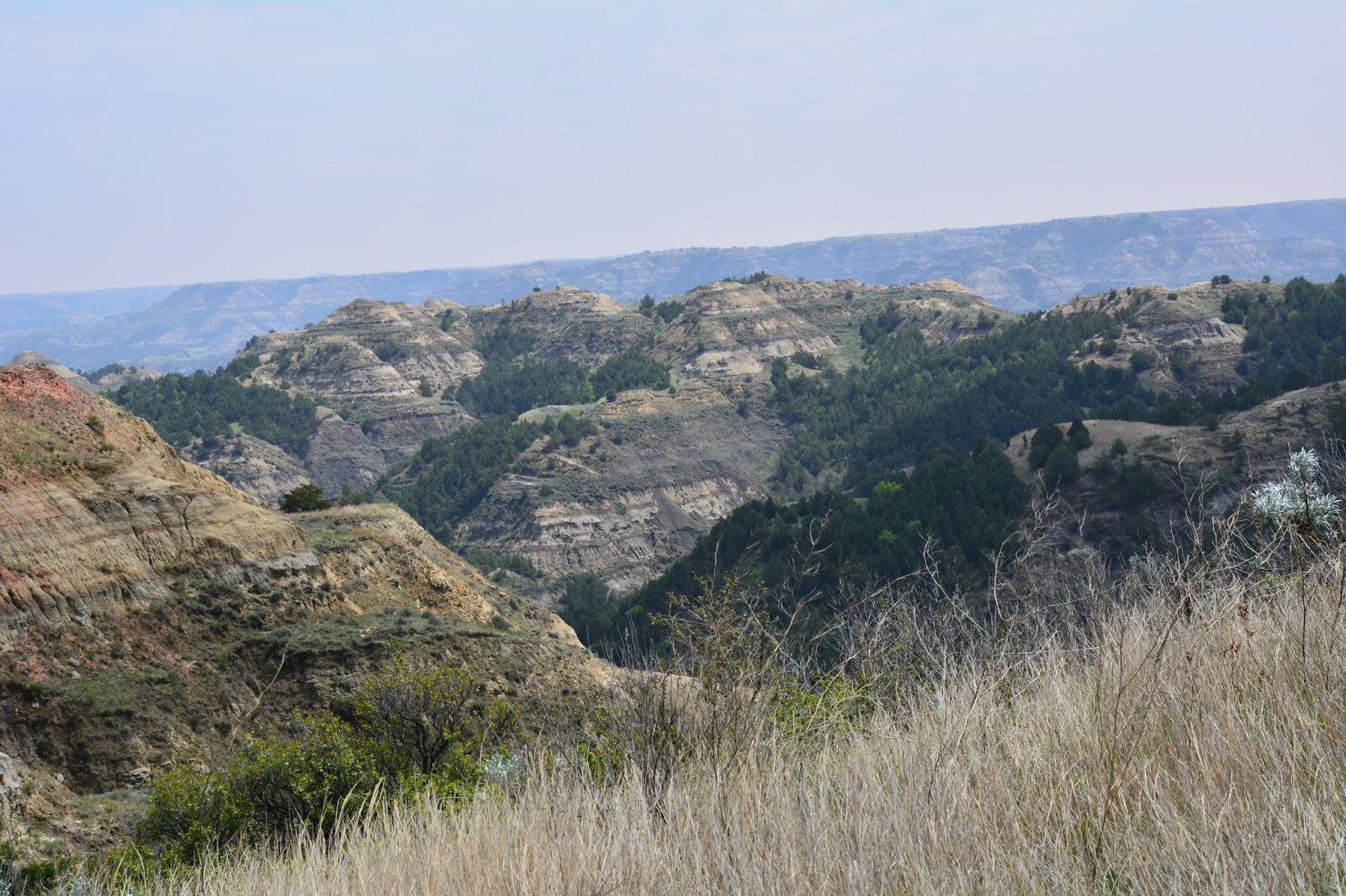

At one point the trial crossed the Scenic Drive and the Oxbow Overlook where we had stopped yesterday. The sun was out, but the far horizons were very hazy, almost smog-like. We wondered if it was from the drilling. That’s the Little Missouri River carving its way through the park.

Bentonite layer laying on top of a ridge.

More caprock forming.

Mushroom-like formation of caprock.

We’re not sure but we think this might be petrified wood, or else it’s a “rain pillar” that has fallen over.

At one point we walked along a ridge with huge valleys on either side.

More caprock. Did we mention that there are lots of caprock in this park?

We are at the highest point on the trail; you can see it extending out along the ridge to the right. That's the Little Missouri on the left.

We not only saw large, huge expanses, but also small, simple delights.

Here is what happens when it rains and bentonite “flows” downhill.

A friend along the way. I’m using a telephoto lens because we are warned over and over the bison are dangerous and to observe them from a distance.
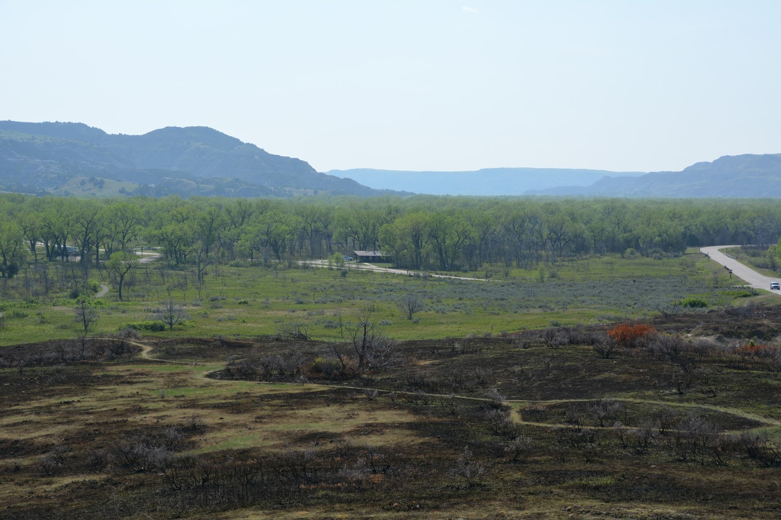
This is our campground nestled in those trees. Adjacent to the campground is another nature trail that looked liked it had been burned over quite recently.
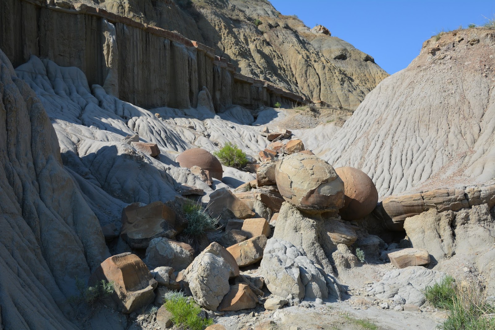
We also went back to see some more of the “cannon ball” concretions - because they are so cool.