Wednesday, January 25, 2017

Picacho Peak Trail

We read that the climb to the top of Picacho Peak was difficult - but rewarding! - in the park information. The trail travels on the south side and is steep and twisting, with steel cables (gloves are recommended) anchored into the rock in places where the surface is vertical and bare. Hiking boots with "aggressive tread", that can grip the rock, are also recommended and this trail is not recommended during hot weather seasons. (Italicized in the park brochure.) Since it is not hot weather by Arizona standards - in fact there is another freeze warning for tonight - it seemed like the perfect weather to attempt the summit.

It was a beautiful day for hiking with temperatures in the 50s and a nice clear, blue sky.
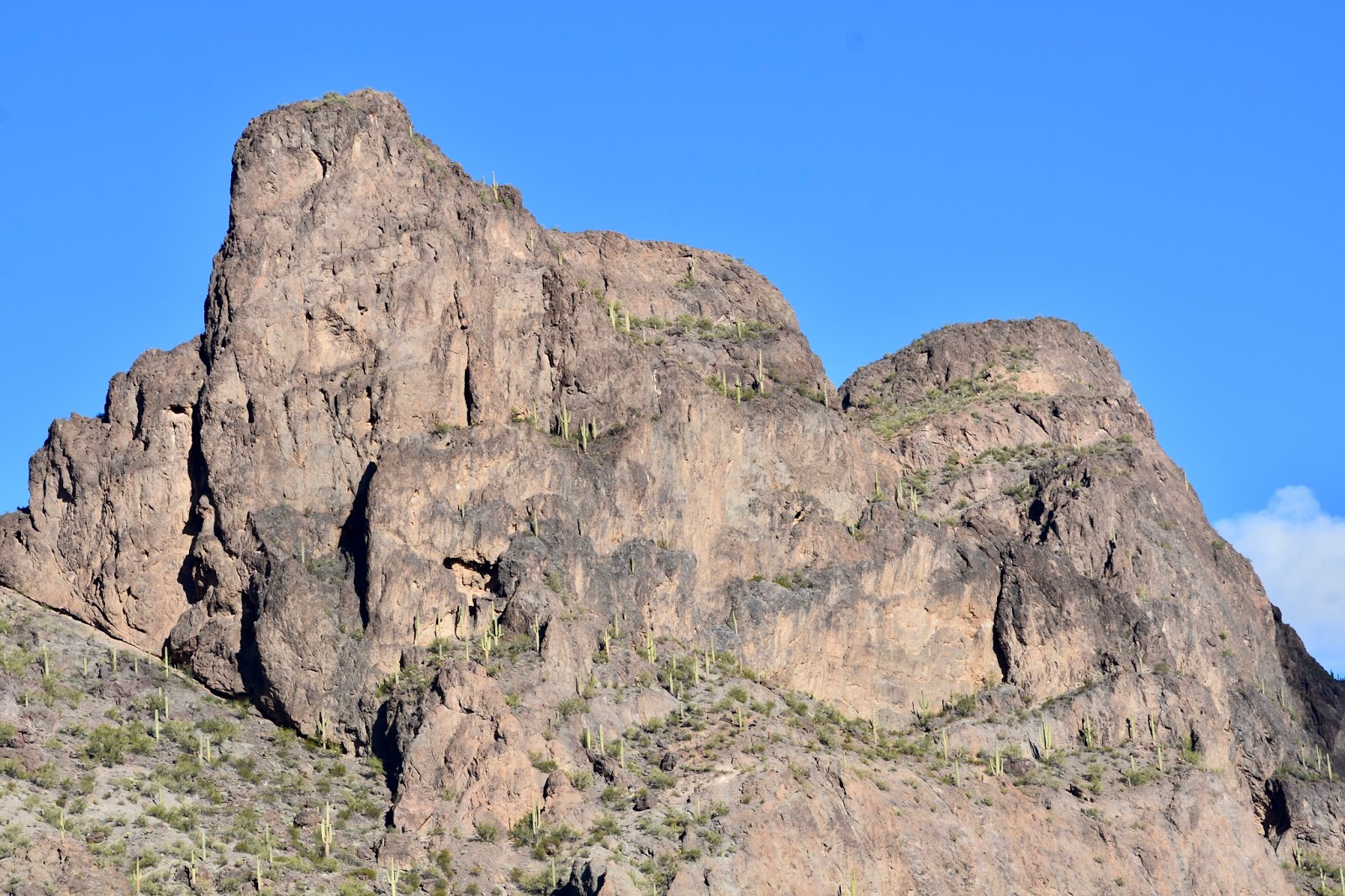
Picacho Peak from the base of the mountain. The knob to the right is actually quite a bit higher than the one on the left, and the one on the right is the summit.

Here's another hiking couple ascending the first set of cables. Even though this climb is almost vertical, it isn't too bad because there are places to put your foot to haul yourself up the mountainside.

Frederick beginning the same climb.

This was the most challenging section for me. A vertical climb up a crevice. The places to put your feet were quite far apart and I had to place my foot on the side of the crevice and haul myself up with my arms.

We did make it to the summit in time to eat our lunch and there he is! Our familiar lunch companion.
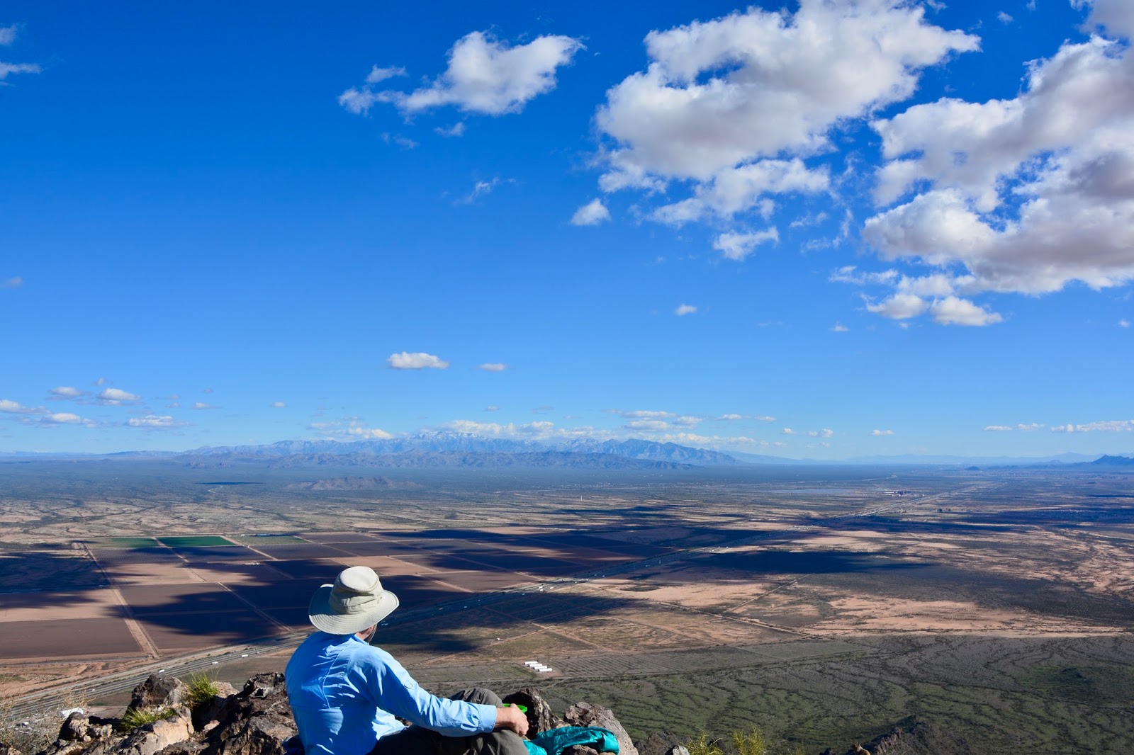
Lunch spot on the top of Picacho Peak.
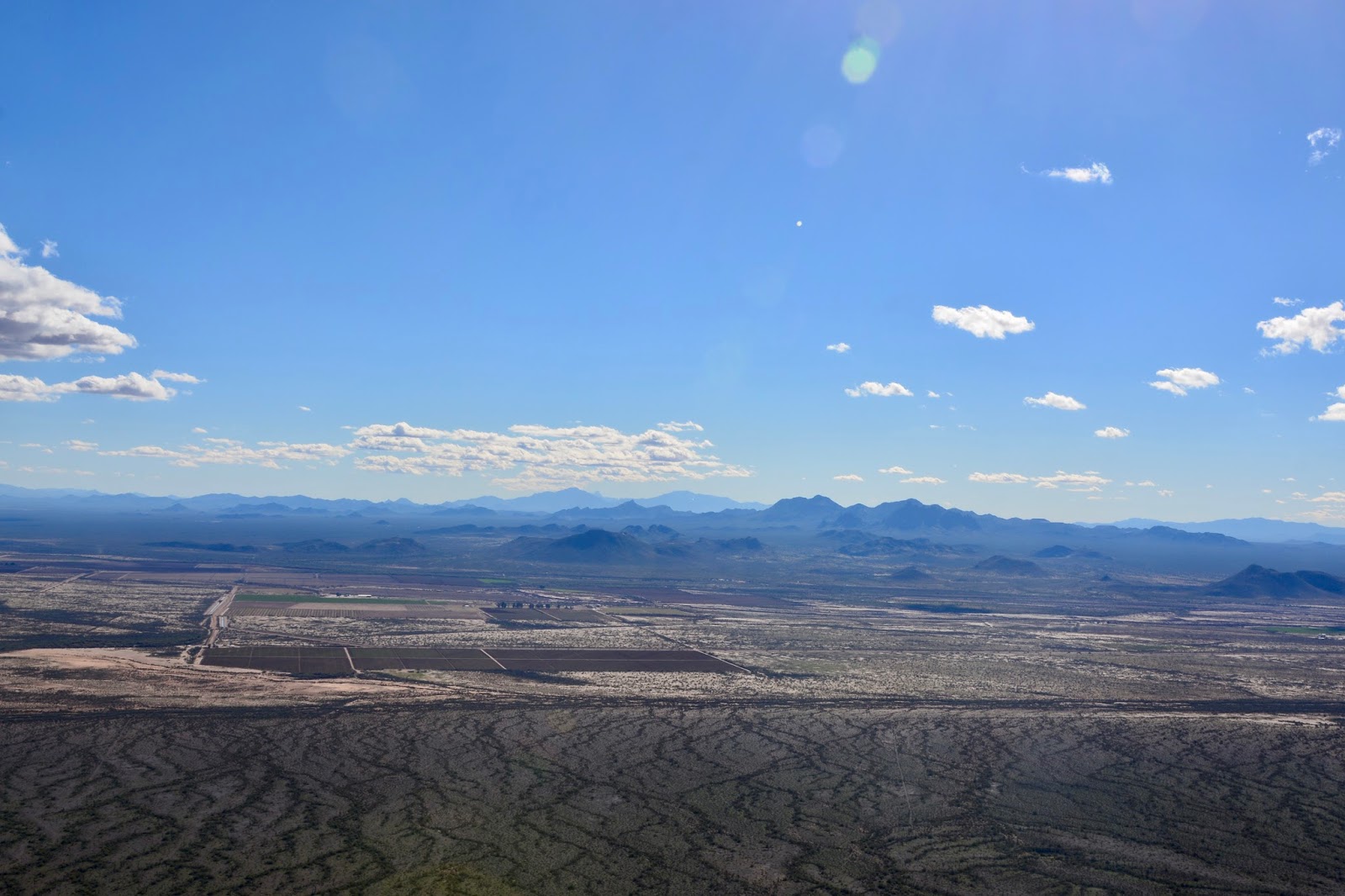
One direction of our 360 degree lunch view.

Looking north toward Phoenix. That's the campground at center left.

Looking south toward Tucson.

Closer view of the campground. (click on the pictures to enlarge them.)

Captured with the telephoto lens from the summit, a view of the campground and our Airstream. (Be sure to click on the picture to see the details.) There are 3 loops in the campground and we are in the third, or top, loop. Our Airstream in in the interior of the loop about 1 o'clock. You might notice that there are three other Airstreams in our loop adjacent to us and a 5th Airstream just to the right of the top bathroom. Other than the Alaska Caravan, we have not been in a campground with so many Airstreams.

There are no pictures from the rest of the hike. Before we started down from the summit I put the camera in the backpack. I was afraid that it would get banged against the rocks as I descended backwards on the cable sections.

Today's hike:
Length - 6.2 miles
Duration - 5 hours, 17 minutes (including lunch)
Elevation gain - 1,530 feet (158 floors on the Fitbit)


Tuesday, January 24, 2017

Dos Amigos

First task today was to finish cleaning and polishing our vehicles. Frederick opened the rock screens so I could get at the Airstream behind them (they sure are pock-marked from our trip to Alaska!) as well as opening the front window screens so I could clean the windows. Then, the Airstream was done.

Next task was to apply a coat of wax to the Benz and buff that to a shine. It's kind of hard to do the Benz because it's white and the dried polish doesn't show up well.

All-clean Airstream and...

Benz.

We finished with the vehicles about 2:30 pm, time enough to find a trail here in Picacho Peak State Park. We chose the Sunset Vista Trail, or, at least, part of it.

The trail skirts the back of Picacho Peak on the west side. 

Lots of saguaro cactus to keep us company. The one in the middle is growing quite a few "arms".

The "back" side of Picacho Peak.

We called these two "Dos Amigos" because it looks as if they have their "arms" around each other. (Click on it to enlarge for a better view.)

View to the west in the late afternoon sun. Basin & range.

A half-mile from the trailhead on the way back we encountered rain followed by snow. I tried to get a picture of Frederick hurrying down the trail in the snow but, alas, the snow didn't show up in the picture.

Today's hike:
Length - 4.05 miles
Duration - 1 hour, 50 minutes
Elevation gain - 720 feet (76 floors on the Fitbit)

Monday, January 23, 2017

Picacho Peak State Park

Picacho Peak State Park is located on I-10 just about mid-way between Phoenix and Tucson and about 100 miles from Apache Junction. When Frederick checked the weather along our route this morning he learned that there was a high wind warning. Electronic sign boards, just outside Phoenix, warned of "low visibility because of blowing dust between Phoenix and Tucson." Sure enough, it was windy, but no dust! I think because of the recent rain the usual dust is missing, even in areas along the highway that warn of "High Dust Area". Oh, and did I mention that it is raining this evening? At least it seems to be good for keeping the dust down!

Earlier this month one of the Airstream blogs that I follow mentioned getting their Airstream washed at a Blue Beacon Truck Wash. They commented that it was good value and if you ask for soft brushes there will be no new scratches. The last time we had the Airstream washed was September. We had asked about getting it washed in polished at the Airstream dealer in Fairfield during our winter break, but they were going to charge over $500 for the wash and polish.

With all the driving in the rain, the Airstream was pretty grimy and it hasn't been polished in about a year. I went online and found that there was a Blue Beacon Truck Wash 9 miles from our exit to Picacho Peak State Park. 
Waiting our turn at the Eloy, AZ, Blue Beacon Truck Wash. Notice the wind-blown palm tree.

There was a harvested cotton field next to the truck wash and a bush that still had some cotton attached.

Inside the Blue Beacon.

We opted for the hand drying and here is Katherine doing a might good job on our rig.

She did an excellent job and honored our request that she swipe the towel side-to-side instead of up-and-down along the aluminum grain. She did such a good job that we were able to apply polish and buff the Airstream when we got to the campground and un-hitched without having to do any other preparation. (I guess we have to take responsibility for the rain this evening - after all, we washed our vehicles today!)

A little further down the road was Picacho Peak and the state park campground at the base.


Sunday, January 22, 2017

Apache Junction

Four days, four movies - La La Land, Manchester by the Sea, Lion and Hidden Figures. Even though the Academy Awards nominations are not announced until Tuesday, January 24, I would think all of these movies will receive a nomination. Frederick liked La La Land, me, not so much. I thought it was curiously joyless for a musical. I think it was a mistake to see Manchester by the Sea on Friday, already a depressing day. It was well acted, but not a particularly up-lifting movie. Lion, viewed on Saturday,  was a satisfactory antidote. Today's movie, Hidden Figures, we enjoyed the most of the four.  
Yesterday we saw this cute little vintage Airstream arrive in the RV park. We don't know what year it is but it sure is tiny.

This two-story RV is parked across the road from us. Interesting design, but I don't know how easily it is towed.

No rain today, yet, so we went out to take some pictures of the Superstition Mountains as viewed from  the vacant lot across the street from the RV park.

Immense saguaro cactus and...

a close-up showing the snow on the mountains outside Phoenix.

Thursday, January 19, 2017

Let's go to the movies!

The original plan had been for us to spend one week at Dead Horse Ranch State Park, arrive on Monday, January 16, which we did, and stay until next Monday, January 23. However, we have been keeping an eye on the weather forecast and saw that another winter storm was being predicted for northern Arizona this weekend with "heavy snow" in Cottonwood on Friday and Saturday; someone told us that Sedona was expected to receive 5 inches of snow. We decided that our best option was to "head south" and we found a KOA in Apache Junction, east of Phoenix. (Did you know that Phoenix is the capital of Arizona?) 

A cold rain began as we were hitching up this morning. We left Cottonwood and climbed another 5,000-ft pass to...

Black Canyon Pass. No clear blue sky today!

Coming down the pass, north of Phoenix we began to encounter...

saguaro cactus. I think these guys are so cute!

Then down into the valley of Phoenix.

Apache Junction is also expecting colder than average temperatures this weekend, along with some rain. While we are here, we plan on going to the movies to catch up on our Academy Award nominee viewing. In fact, this afternoon, right after we un-hitched, we went to see La La Land.


Wednesday, January 18, 2017

West Fork Trail in Call of the Canyon

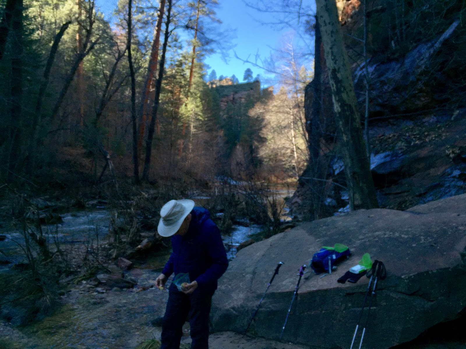
Hiking trails criss-cross the red-rock country surrounding Sedona and green Oak Creek Canyon. One popular hiking trail in Oak Creek Canyon is West Fork Trail which follows the creek through the canyon with the canyon walls rising more that 200ft in places.

(Unfortunately I left the SLR camera at home in the Airstream. The photos below are from my phone.)

Lots of interesting formations at the top of the canyon. We had to "keep looking up" as Neil DeGrasse Tyson always says!

At bit of sunshine at the base of the canyon. Mostly the trail was in shadow and it was cold - the trail is at over 5,000ft. elevation and there were patches of snow along the base of the canyon.

There are 15 creek crossings on the trail. When we arrived at the trailhead the woman who took our money mentioned that the "river is running hight today. You might get your feet wet." We made it over 5 crossings on logs and rocks, but the only way to cross #6 was to wade through the river. We declined and decided to stop and eat our lunch instead.

Our lunch view.

Today's hike:
Length - 3.23 miles
Duration - 2 hours, 7 minutes (including lunch)
Elevation gain - 260 feet (29 floors on the Fitbit)

Tuesday, January 17, 2017

Eagle's Nest Trail

Seventeen miles north of Dead Horse Ranch State Park is Red Rock State Park, on the outskirts of Sedona. The park is a 286 acre nature preserve with trails throughout that wind through manzanita and juniper to reach the rich banks of Oak Creek. The Eagle's Nest Loop and the Apache Fire Loop trails are joined together by the Coyote Ridge Trail - we hiked them all today.

This picture is from the scenic overlook at the Visitor Center.

Along Oak Creek. If you enlarge the picture by clicking on it you might notice the dwelling at right center. This house is called House of Apache Fires and was built by Jack and Helen Frye in the 1940s where they hosted many celebrities and dignitaries. Jack Frye was an aviation legend and co-founder and President of Transcontinental & Western Air, better known at TWA. In 1986, Arizona State Parks acquired the house and the 286-acre parcel of land that became Red Rock State Park.


View from Eagle's Nest viewpoint. Yes, we are happy to be back on the trail!


Toady's hike:
Length - 2.3 miles
Duration - 1 hour, 14 minutes
Elevation gain - 230 feet (26 floors on the Fitbit)