Saturday, September 12, 2015

The Garden Wall

The Garden Wall section of the Highline Trail can be hiked as a loop, beginning at the Logan Pass Visitor Center and exiting at The Loop, the northernmost hairpin turn on the Going-to-the-Sun Highway and approximately 10 miles, by road, from Logan Pass. Most hikers park at The Loop, take the park shuttle up to Logan Pass and begin the 13.6 mile hike and end up at their car when they finish the hike. But, the park shuttle ceased running after Labor Day so how do we get from The Loop  to Logan Pass? Hitch-hike!

We got an early start leaving the Airstream before 9 am, and drove the 1 hour drive to The Loop and parked the car. We got our hiking gear ready and stepped to the side of the parking area where Frederick held up the sign he had made - LOGAN V.C. - and I stuck out my thumb just as a pick-up truck was driving past. Five seconds later, a car pulled over about 30 feet from us. A woman stepped out and said, "I think we can take two", and she and the woman driver began to clear the back seat, putting their bags in the trunk. We hopped right in.

Donna (Portland, OR) and Ellie (Olympia, WA) are college roommates from 30+ years ago and this was the first time either had visited Glacier National Park. We had a pleasant 20 minute drive to Logan, talking about books and visiting different parts of the country. They did us a good deed and their reward was finding a parking space at the Logan Visitor Center that was the first spot just outside the door.

The Garden Wall hike is one of the most popular hikes in the park because of its spectacular vistas and excellent wildlife-viewing opportunities. Here are the pictures from our day.

We began at about 10 a.m.

Looking back, towards the Visitor Center, at Clements Mountain. Notice that, again today, the sky is clear blue.

The trail cuts underneath the Garden Wall ridge just below the Continental Divide. The Garden Wall is a sharp, glacier-carved ridge that is called an arete. There is a steep drop-off and you can see the hand railing for those who might suffer from vertigo.

For the first part of the trail we followed the same side of the mountain as the Going-to-the-Sun Highway and you can see it at the bottom of the picture. Those with sharp eyes may be able to see the trail. It is still in the shade because the sun hasn't risen high enough to clear the ridge.

Hiking the trail in the shadow of the Garden Wall.

Stunning views of the Highway and...

the trail ahead, below the Garden Wall (upper right).

Across the valley peaks with remnants of glaciers.

Looking back up the valley towards Logan Pass and Mount Clements.

Gate of Heaven Mountain high above McDonald Creek which empties into Lake McDonald. The Going-to-the-Sun Highway runs along this creek.
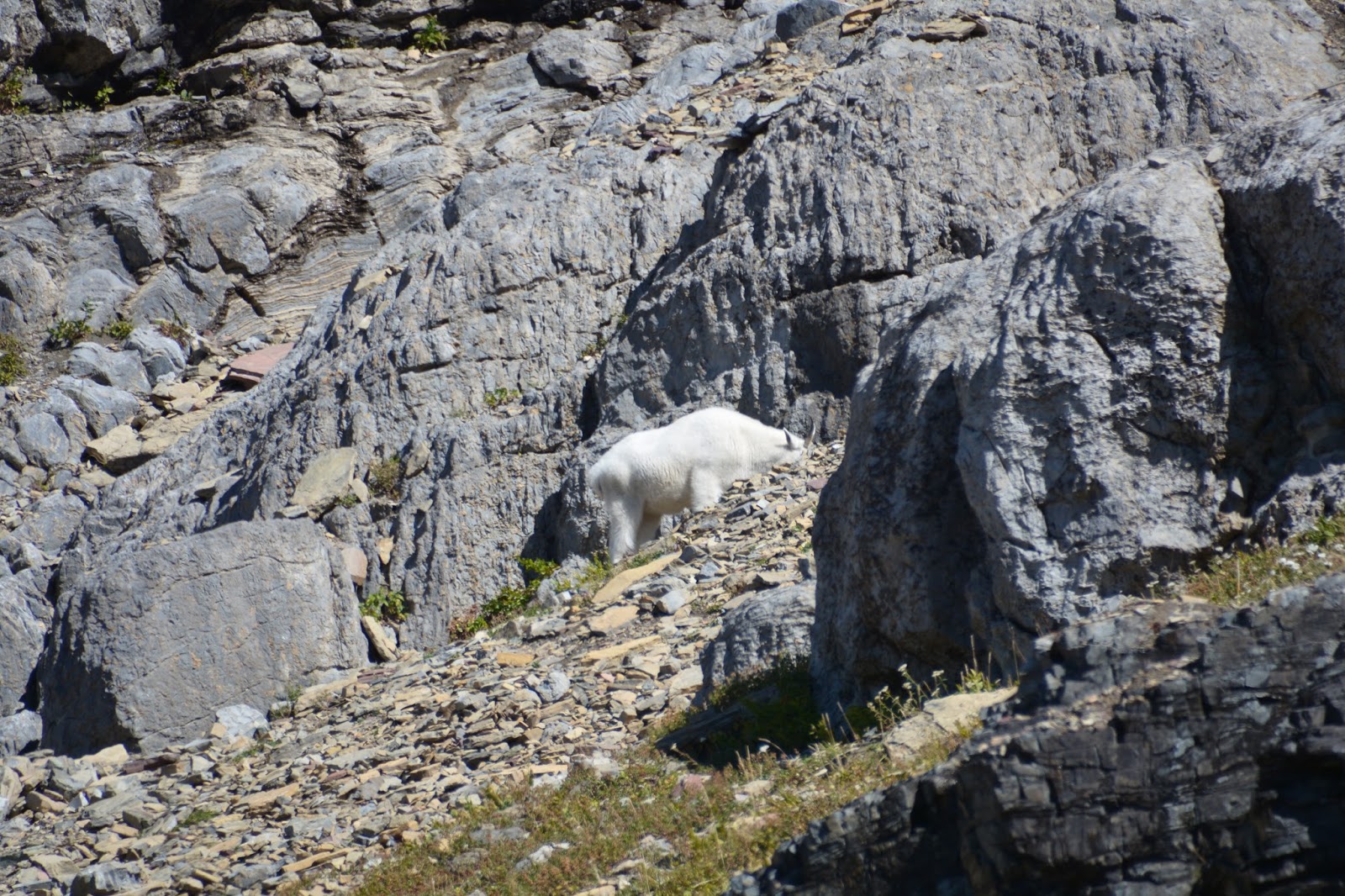
Our first wildlife sighting - a mountain goat. It was great to see a semi-wild one instead of the ones we have seen along side the road.

There were no wildflowers remaining after the winter storm of a few days ago, but the mountain meadows have low plants that are turning red.

A view up to the Garden Wall.

Haystack Butte that juts into the Logan Creek Valley.

Shy, and elusive, big-horn sheep.

Lunch time.

More of the Garden Wall.

Looking down the valley at McDonald Lake.

At approximately 6.8 miles, a spur path "offers gluttons for punishment" the opportunity to climb approximately 1,050 feet in 1 mile up to a high notch in Garden Wall that overlooks the shrinking Grinnell Glacier. 

Here we ate our lunch with this view.

Icebergs in the lake at the base of the glacier.

Gate of Heaven peak from the Grinnell Glacier Overlook. Lake McDonald in at center left.

Granite Park Chalet appears at about 9.6 miles.

Views from the Chalet back along the Garden Wall.

Northeast, behind the Chalet.

From the Chalet, Heavens Peak immediately across the valley.

From the Granite Park Chalet, the trail descends, via switchbacks, down 2,353 feet to reach The Loop, and our car.

The trail passes through burned patches of trees from the Trapper Creek Fire of 2003.

Across the valley we saw another mountain goat with the telephoto lens.

Just before the parking lot at The Loop, the trail passes over a bridge with this cooling waterfall - it was 80 degrees.

Meet Mark, on the left, and John who shared the trail with us today. Two friends hiking the Garden Wall Trail, we followed John's blue shirt for most of the first half of the hike. At about the half-way point they stopped for lunch and we passed them by. We met up again at the Grinnell Glacier Overlook and at the Granite Park Chalet. About a mile before the end of the trail they passed us again, and led the way to The Loop. At the end of the trail - that's why everyone is smiling - John asked if he could take our picture - they were impressed that we demonstrated such vigor on the trail (at our age). I asked if I could take their picture because they were such good trail partners for us.

Garde Wall Trail statistics - 

13.6 miles
Elevation gain - 830 ft. plus 1,050 ft (Grinnell Glacier Overlook) - 251 floors
Time - 7 1/2 hours

Thursday, September 10, 2015

Hidden Lake Overlook Trail

We found the scenery! Today we finally drove the Going-to-the-Sun-Road to Logan Pass Visitor Center and hiked the most popular trail in the park - the Hidden Lake Overlook Trail. We went about 4 miles and climbed 500 ft. (80 floors on the Fitbit). After yesterday's marathon we were looking for something a little more measured and we found that, and more, with this trail.

The weather today was spectacular - as the Ranger at the Logan Pass Visitor Center said, "It's the first clear day we have seen in a month, what with the smoke from the fires and the clouds, snow and stormy weather." Up at Logan Pass the temperature was in the high 50s, but down here in the campground, it is 80 degrees.

So here is what the fuss it all about concerning the stunning scenery at Glacier. We agree that it is spectacular!

Mount Clements towering over the beginning of the trail. Notice the blue sky!

Hidden Lake from the viewpoint, looking down the Sperry Glacier basin.

Another view of Hidden Lake. I think we were actually lucky that there was snow a couple of days ago, it enhances the scenery.

Our lunch spot just beyond the viewpoint of Hidden Lake, the spot where most people turn around and go back to their cars.

The view from our lunch spot with Bearhat Mountain on the right.

Hidden Lake from a little further down the trail towards the lake.

Down the valley with McDonald Lake in the distance.

This is as far down the trail towards the lake that we travelled. There's Bearhat Mountain again.

On the way back to the Visitor Center we passed this tarn that still had ice on it.

Someone had built a snowman along the trail and one of our fellow hikers is making his acquaintance.

Chiseled out of the mountainside, the Going-to-the-Sun- Road is visible at the bottom of the Garden Wall. 

View to the northwest, back down the Road,...

and to the east, towards St. Mary's and East Glacier.

Wednesday, September 9, 2015

Numa Ridge Lookout

Finally, scenery and vistas worthy of the effort of the hike, and today's hike was quite challenging for us - 12.08 miles; elevation gain of 3,000 ft. (332 floors on the Fitbit, our second highest floor count). The trail began at Bowman Lake in the remote North Fork Valley in the northwest area of Glacier Park and getting to the trailhead was a challenge. From the Polebridge Entrance of the park to Bowman Lake is six miles and it took us 30 minutes to drive the twisty, potholed and rough road. The posted speed limit was 20 mph, and most of the time there was no way you could drive 20 mph on that road. But Bowman Lake is spectacular1

Bowman Lake, trailhead of the Numa Ridge Lookout trail.

From the trail, previews of the breathtaking sights that await us at the top of the ridge.

Bowman Lake from near the top.

As you can see, there were clouds sitting on the tops of the highest peaks.

Wildlife on the trail -

A large tree frog (in the middle of the picture)...

some more grouse?and...

a fox (the first time we have seen a fox in the wild).

The closed lookout at the top of Numa Ridge. Notice the cables that keep the lookout in place when the wind blows. 

Peaks from Numa Ridge, to the east.

Behind the lookout, the big peak (left, back) disappears in the clouds.

Looking southeast, Bowman Lake at the bottom right and mountain ridges that go on-and-on.

Bowman Lake at the return from the hike.

They seem to be serious about getting a permit - $5,000 plus 6 months in jail!

Tuesday, September 8, 2015

Apgar Lookout

Today's trail was fairly short, 7.3 miles, but moderate because we climbed 1,900 ft., 201 floors on the Fitbit. For me, the jury is still out on Glacier Park in terms of scenery, vistas and interesting trails. Maybe if the sun would come out and it was a little warmer the trails would seem a little more inviting. Then again, I am comparing the trails to the Canadian Rockies. Tomorrow maybe we'll try a trail off the Going-to-the-Sun-Road at a higher elevation

What bird is this? About the size of a small chicken.

There was a family of them on the trail and they pretty much ignored us.

Half way up the trail we had this view of the valley of the Flathead River's South Fork and Apgar Village at the West Glacier entrance.

The Apgar Lookout


Lake McDonald nestled among the foothills of the Livingston Range.

Peaks flanking the upper end of Lake McDonald with some fall color beginning to show up.

This device was just down the hill from the lookout - looks pretty serious and is the property of the U.S. Government.