Next we went to the Parks Canada Visitor Center to discuss trails and maps. We were able to buy several Gem Trek maps at the Visitor Center, but the ones for Jasper and the Icefields we had to track down in one particular local outdoors store (and there are many of them!).
Then we visited Mountain Chocolates, "Where the whole world comes to buy chocolates." Unfortunately, they did not have any just plain chocolate; only chocolate with caramel or some type of nut. But we did find Chocolaterie Bernard Callebaut tucked away in the back of one of the "malls" that line the street. They only had a very limited selection of plain chocolate, but we bought one 2 oz. dark chocolate bar that we will try tonight.
By now, 2 p.m., the rain had stopped so after a quick lunch we headed up Sulphur Mountain knowing that we would probably not be able to enjoy one of the most famous views in Canada because of the continuing clouds and threatening rain. Tens of thousands of people ride the gondola to the 2,281-metre-high (7,486-foot) summit of Sulphur Mountain each summer, but it is also possible to walk up the mountain.
The trail gains 700 metres (2,300 feet) of elevation with 28 switchbacks, 11 km (6.8 mi), rated moderate. Here are some views:
Start of the trail. See the You Are Here star and follow the red line as it zig-zags up the mountain. The straight grey like is the gondola.
Simply put, To Summit sign.
Part way up, the trail passes under the gondola...
several times.
There it is - the fabulous, 360-degree panorama view of... clouds
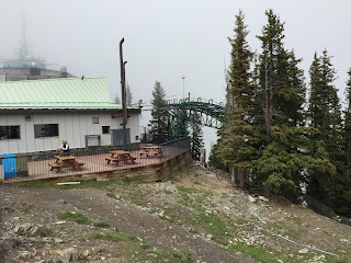
Upper gondola terminal. Can you imagine how disappointing it must be for people who only have one day in Banff to take the gondola up to the top of the mountain for a view of clouds.
This is Sabine Bork from Frankfurt, Germany. She passed us on the last switch-back practically running up the trail. She came over to talk with us and ask how long it took us to climb the trail (2 hours). She lives a fair amount of time in Banff and hikes up the mountain in 1+ hour, just for exercise. We had fun talking with her and maybe we'll see her around town.
For a brief moment, while we were at the top, the clouds parted a bit and we were able to get this picture.
On the way down it began to rain and hail, but we were prepared. There were some open patches in the clouds lower down the mountain.
Though the trail is forested throughout, views over the town and valley do open briefly as we pass by a waterfall on the mountain's slope. Here's the waterfall, and...
here's the view to the town and valley with a spectacular rainbow blessing our day's hike.
(Since it was raining on-and-off today, we did not take the new camera and lenses but instead relied on the iPhone.)
This is a selfie from yesterday's hike - at the Upper Falls in Johnston Canyon.


No comments:
Post a Comment