Remembering what I wrote yesterday, this morning, when we passed an Information Center about a mile down the road, we stopped in to get specific directions to a couple of places we wanted to go to today and to get some information about where we will be going in the next week to ten days. We came out loaded with pamphlets and brochures.

Karen and Adrian who staffed the Information Center today. Karen is from Labrador and was able to tell us about some places to eat when we travel to Labrador.
Yesterday, driving to Corner Brook and the north shore drive, we noticed a highway sign for Pasadena, and Meyer's Minerals. It was one of those spur of the moment decisions to get off the Trans Canada Highway, go into Pasadena and see if Meyer's Minerals is open on Sunday. Initially it didn't look good, but we parked outside a huge building with a number of businesses occupying their own space and found, to our pleasure, that Meyer's was open.
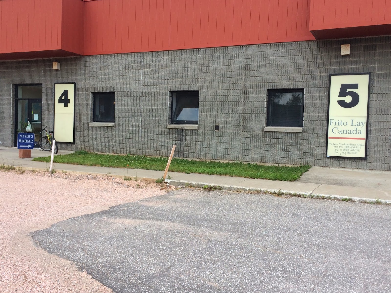
Meyer's Minerals is in space #4. See the little blue sign "Meyer's Minerals" with an arrow? Space #5 is occupied by Frito Lay of Canada.

Inside #4. That's a geology/rock map of Labrador on the back wall. Meyer's only has stones from Newfoundland and Labrador. A speciality is Labradorite.
Here is a little bit about Labradorite from Meyer's Minerals:
"The existence of Labradorite on the northern coast of Labrador was always known to the Inuit. In the 1770's, Moravian missionaries in the Nain area sent Labradorite to Europe where the mineral's beauty was acclaimed in Germany. Mineralogists identified it as a feldspar mineral and named it Labradorite in recognition of the spectacular 1.2 billion year old outcrops in Labrador's Nain region. Found in many locations in Labrador, it is rare on the island of Newfoundland. Uniquely coloured Labradorite found in Finland is called spectrality. However, most Labradorite commercialized today is sourced in Madagascar and made into jewelry in Asia...
The iridescent 'flash' of Labradorite calls to mind the colors of the Northern Aurora Borealis. Greens and blues are most common, but yellow, bronze, red, pink and purple, or rainbow-like mixtures of these colors. The iridescence results from white light entering the crystal at a unique angle, and then undergoes interference and diffraction in a prism-like fashion. This is caused by thin exsolution lamellae that grew in the mineral as it cooled from a liquid melt.
The Labradorite worked in our shop was collected by the owner, Jamie Meyer, from the Pearly Gates deposit west of Nain, with the permission of the Labradorite Inuit Association. The stone was flown by helicopter to the coast, shipped to the island (he means Newfoundland), then trucked across to our shop. This mineral is very brittle, and cracks must be 'healed' as we work the stone. It takes careful selection and proper orientation while cutting and polishing to bring out the mineral's magical iridescence that is captured in (every) piece of Labradorite."

This is Sandra Skeard ("I might be 'scared', but I'm not frightened".) She was very friendly and outgoing and we stayed and talked to her for over an hour. Another couple came in while we were there, looked around for about one minute, and left. Otherwise, we were the only other people there.

Sandra invited us into the back and gave us a tour of the operation. She kept referring to Jamie Meyer as "the Boss". He was a geologist for Canada, and when he left their employ, they allowed him to take out, "one time", some Labradorite. With the permission of the Inuit Association, he flew out a couple of helicopters full of Labradorite.

This is the Labraorite in its raw form. This bin of "rocks" is all that remains of what Jamie Meyer brought out.

Sandre showed us how the stone is cut into slabs. Notice the 13" diamond blade on the left.

A stone, held in place for cutting with the 13" blade on the left.

During the cutting process this cover comes down over the operation because water is used to keep the blade cool.

After cutting Sandra coats each slice with an epoxy stone glue.

The polishing discs; from #50 to #800.

Sandra showing how she "cuts" out the stone for jewelry and ornaments.

Sandra was working on a white marble urn. They do a lot of special request items.
We finally tore ourselves away from Meyer's Minerals and drove into Corner Brook and paid a visit to the Captain James Cook Historice Site. There is a spectacular view of the Bay of Islands from this Site.

Captain James Cook began his study of Navigation and mapping in Newfoundland. During 1762 - 1767 he spent his time mapping the coastline of the island of Newfoundland. His charts were so accurate that they were used into the mid-1900s. In fact, his charts for the Bay of Islands are still used today.

The view of the Bay of Islands.

Frederick and Captain Cook.
Leaving the statue of Captain Cook, we found Route #450, the Captain Cook Trail. This scenic drive is along the south shore of the Bay of Islands to Lark Harbour.

Bottle Cove, just beyond Lark Harbour, where we ate our lunch before we began our hike.

Our hike for today was the Southhead Lighthouse Hiking Trail. It wasn't a trail to a lighthouse because the lighthouse was destroyed in 1996. Here is more information about the trail. https://www.youtube.com/watch?v=TxVioDSFogQ

Nice waterfall along the trail.

The waterfall, lower right, descends right into the bay below.

Looking back towards the Bay of Islands.

Along the trail we noticed this white drawing on the rock face. If you enlarge the picture you can see what looks to us like a moose. (The white spot right in the center of the picture.)

Creative use of a fallen tree. You can see the roots in the upper left. The trunk has been stripped and notched and is supported by another log. Nice bench.

We found this little hand crafted bench by the side of the trail. Just the right size for a Hobbit.

Spectacular views from the trail.
After the hike we returned to Lark Harbour and their Viking Ship.

What this sign says: "The opening and closing scenes of the Viking epic, science-fiction thriller, Outlander, were shot in Little Port, Lark Harbour in the Outer Bay of Islands in October, 2006. Some big name movie stars - Jim Caviezel, John Hurt, Sophie Myles and Jack Huston - were in the area for the filming and were joined by about 100 locals who stood in as background characters."

After filming the boat was gifted to the village of Lark Harbour. (We thought it would be in the water, but there it was, next to the Post Office and the town offices!)

Nice carving.
The next few pictures are for Nathan, who loves trains. Corner Brook has a collection of narrow gauge rolling stock from the Newfoundland Railway including steam locomotive No. 593, working diesel electric locomotive No. 931, snow plow train and various other cars.

Frederick in front of Ol' No. 593.

#593 - a beautiful locomotive.

Her history.
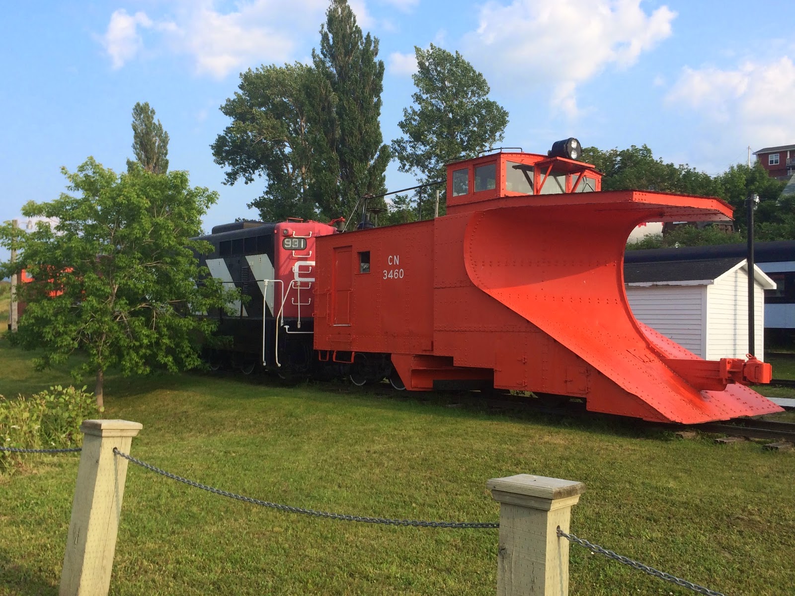
Another gigantic snow plow for the railroad.

The snowplow is being pushed by No. 931.
Tomorrow is moving day so we always try to diesel-up before we hitch-up. At the local Irving Gas Bar, as gas stations are know in Newfoundland, there was a statue of a moose.

Frederick admiring this out-sized moose.

This picture was taken in Maine on June 29. This one is true to size.


