Sunday, June 5, 2016

Yoga on the Lake - Johnson Lake Trail

Johnson Lake has not only a fine hiking trail, but at the western end, near the parking lot, there is a fine beach and picnic area. We came for the hike.

Throughout the warmest weeks of late spring and summer, the beach at the west end is a playground for Banff residents.

The trail along the shoreline is purported to be a perfect example of a low-elevation montane forest. For this picture, we are on the south shore looking across the lake to the north shore where we spotted the Canadian National Parks' "Red Chairs".

At the far end of the lake, away from the beach, we encountered a yoga class being conducted on paddle boards - I guess just to add to the fun.

Because sound travels so well across water, we were able to hear clearly the directions  given by the instructor. She's the one in the middle not doing the "downward facing dog." The young woman on the right seemed to be having a little trouble with her board.

On the perimeter of the class, this man seems to be doing his own kind of yoga. 

Balance with your arms in the air and bend at the knees - a deep as you can go.

This looks like a "plank", but it probably has a more technical yoga term. Rose, do you know what this position is called?

After we circled the east end of the lake and left the yoga class behind, the trail split but the right fork was closed to people.

From an elevated spot on the north shore we got this view down the lake. The trail on the south shore is through the forest on the right.

We made it to the red chairs and Frederick took in the view.

The perimeter of our campground is home to quite a few prairie dogs this year. Here's a mama prairie dog and if you click on the picture to make it larger you might be able to see the nursing baby.

When you approach any closer, the prairie dog will give a sharp "bark" and disappear into its hole.

This afternoon we took the four-mile hike on a trail that circumnavigates all the various campgrounds on Tunnel Mountain. Here we encountered two deer. 

There seems to be lots of nice green grass for browsing.

At one point in the hike we had this overview of the town of Banff and...

the Bow Valley. In this picture, the town of Banff is just to the left.

Today's combined hike:
Length - 6.37 miles
Duration - 2 hours, 54 minutes
Elevation gain - 320 feet (33 floors on the Fitbit)

Saturday, June 4, 2016

Lake Minnewanka - 2016

We have found Tim Jensen's book, The Best Day Hikes in the Canadian Rockies, and are beginning to put it to good use. Last year when we were here we found his book to be the best of the handful of trail guides we have. For the Banff area he has Johnston Canyon, which we hiked yesterday, and today we took another of his recommended hikes, around the north side of Lake Minnewanka. We hiked this trail last year on June 22 and you can read the blog here -

http://venturing4th.blogspot.ca/2015/06/lake-minnewanka.html

In re-reading last year's blog, I note that we said that the day was the best we had, so far, in Banff. That goes for today as well. Clear all day with temperatures in the upper 70s. It's beginning to feel as if it may soon be summer.

The trail began at the far end of the picnic area at this popular lake, and just before we got to the trailhead we passed this group getting ready for a Saturday morning wedding. (If you click on the picture to enlarge it, you might be able to see the white chairs being set up at the water's edge and note the arriving wedding guests.)

About 0.5 km we crossed over the Cascade River as it flows through Stewart Canyon on it's way to Lake Minnewanka.

A primrose along the trail. The wild rose is the Provincial flower of Alberta.

This picture, from last week, shows the wild rose on the Alberta greeting sign.

About one mile along the trail, we looked up to find a herd of big horned sheep looking down on us.

This young lady seemed particularly interested in us.

The highest point on the trail that provides an overview of the lake.

Hiking along the north side of the lake. We will hike to the far end, about 5 miles.

Frederick at our lunch spot at the end of the lake.

Pano of our lunch spot view across the lake.

Lake Minnewanka, also named Devil's Lake by the First Nations, is one of the deepest and largest lakes of the Canadian Rockies. The deep water gives the lake its intense dark blue color. Lake Minnewanka is the only lake in Banff National Park where motorized boats are allowed. Here, at the end of the lake, several boats are trying their luck at fishing.

As we walked back up to the trail from the water's edge, we passed through this patch of sage and aspen. The fragrance of the sage this time of the year is heavenly. It reminds me of Texas.

Recrossing a two-log bridge along the trail.

Heading west along the lake, back to the marina and picnic areas.

Just about back to the marina which is around that spit of land in the center of the picture.

View across the lake from near the picnic area.

Today's hike:
Length - 10.92 miles
Duration - 5 hours, 37 minutes
Elevation gain - 132 feet (100 floors on the Fitbit)

Friday, June 3, 2016

Most popular destination in the Canadian Rockies - Johnston Canyon

All the guidebooks, trail maps & guides, day hiking leaflets describe the hike and they all say the same thing - its the busiest hiking trail in the Banff area and expect lots of company. We hiked the Johnston Canyon Trail three times last year and, yes, it can be crowded. Today though, at the beginning of June, the crowds were not bad. It is also an "easy" trail with only moderate elevation gain, perfect for another tune-up hike this first week in Banff.

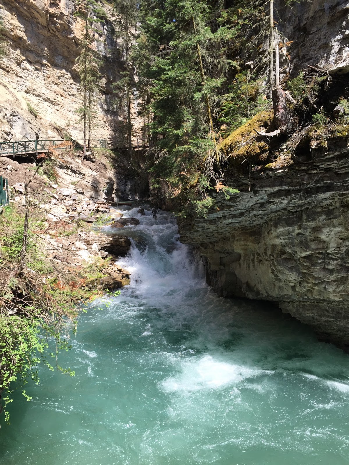
The entire trail is along flowing water which, this time of the year, can be furious through steep cliffs and rocky walls. The Canyon has been formed over 350 million years, a period in which the water flow has cut deep through the limestone walls. There are at least seven waterfalls, two that are enormous.

At the trailhead, we got a glimpse of Castle Mountain, just down the road on the Bow Valley Parkway.

Canyon views. We had waited until there was a forecast for a "clear" day. The temperature was in the low 70s.


The first of the seven waterfalls.

Two

This is Lower Falls. We crossed a bridge over the creek for a viewpoint that is up-close and wet.

Waterfall #4

#5

This is Upper Falls.

Waterfall #7, above the Upper Falls. Notice the people who have climbed over the guardrail and are sitting on the rocks next to the falls. Too bad they can't read the many signs that specifically prohibit such action. 

Descending the trail we could see this peak that looks like the Matterhorn.

Since Jacob wasn't here to bend the tree, Frederick exerted the force. (No trees were injured in the creation of today's blog.)

First waterfall selfie of the year. I'll have to find the selfie stick so that the waterfall and the two of us can all be seen clearly in the same picture.

Today's hike:
Length - 3.87 miles
Duration - 2 hours, 39 minutes
Elevation gain - 600 feet (66 floors on the Fitbit)

Thursday, June 2, 2016

Fenland Trail with Vermilion Lakes add on

The Fenland is a short "nature" trail on the edge of Banff that loops through forested areas beside Echo and Forty Mile Creeks and the marshland beside the Vermilion Lakes.

The "fen" in Fenland Trail. A fen is a type of wetland that is fed primarily by nutrient-rich groundwater. The availability of water throughout the growing season creates a fertile oasis in this generally dry and sparse mountain environment. Plants such as sedges, grasses and mosses thrive here.

We stopped and had our lunch beside the Forty Mile Creek. There were several canoes and kayaks that went by.

The view from our lunch spot.

This is the first of the three Vermilion Lakes. We could see rain falling in other parts of the valley.

Mt. Rundle from the second Vermilion Lake.

Mt. Rundle (on the right) and other peaks that surround Banff, from the second Vermilion Lake.

Today's hike:
Length -3.94 miles
Duration - 2 hours, 25 minutes (including lunch)
Elevation gain - 110 feet (11 floors on the Fitbit)


Wednesday, June 1, 2016

Spray River Trail - getting acclimated

We are taking it slowly, easing back into hiking, especially at this elevation. (I was rudely reminded of the altitude when I tried to bake a lemon poppyseed cake in a loaf pan on Monday. For the 35 minutes it was in the oven it oozed up and over the sides of the pan onto the brand new pizza stone that is supposed to better diffuse the heat in the oven. Then, as it was cooling in the pan for ten minutes, the entire loaf collapsed into a hole. Each slice looks as if it has a huge divot is carved out of it, but, it tastes great!)

The guide book, 50 Walks and Hikes in Banff National Park, by Brian Patton & Bart Robinson, refers to the Spray River trail as "a pleasant but unremarkable trek into the wilderness surrounding town." Maybe it's not a great hike, but there were some beautiful views.

Not too far into the hike, maybe 0.5 miles, we stopped for lunch. This is our lunch spot...

not too far from this bridge across Spray River.

From the bridge, we could look north, up the river, to the castle-like Banff Spring Hotel. (If you click on the picture to enlarge it, you might be able to see the Canadian flag flying over the hotel.)


Our first sighting of red Indian Paintbrush.

We crossed the bridge and climbed the hill and passed this overlook. That's our lunch spot, across the river just into the trees to the left of the bridge. (If you click on the picture to enlarge it, you can see the hotel at the Banff hot springs and the gondola up Sulphur Mountain.)

Further up the trail we had this nice view from a Spray River overlook.

Today's hike:
Length - 4.2 miles
Duration - 2 hr., 30 min. (including lunch)
Elevation gain - 240 ft. (24 floors on the Fitbit)