Friday, August 7, 2015

Wilcox Pass

We have been anticipating the Wilcox Pass Trail since we went on the Burgess Shale hike at Stanley Glacier and one of the rangers recommended the hike which is on the Icefields Parkway. We have just about completed the hikes we wanted to do near Jasper, Maligne Lake and Miette (pronounced mee-YETT) Hot Springs. Even though it is over an hour drive to the Icefields Center, our Jasper campground is the closest location to the trailheads.

Tim considers Wilcox Pass to be a beautiful hike and one everyone visiting the Canadian Rockies should see. 

Our elevation gain today was 355 meters, or, as the Fitbit recorded, 188 floors; the hike was 6.25 miles.

It was one of the "rootiest" trails we have taken - a tripping hazard with every step - and it's harder coming down than it is going up.

About 2 km up we reached the tree line and entered open meadows which opened up great views. That's the Athabasca Glacier and you can see the road at the bottom of the picture.


The Park Service had placed two of their red chairs at a ridge overlooking the Columbia Icefield Centre and Mt. Athabasca. Just so you all know, Frederick spent all of 10 seconds sitting in the chair, just long enough for me to take this picture.

Up at the pass summit the views are stunning. Here's the Athabasca Glacier.
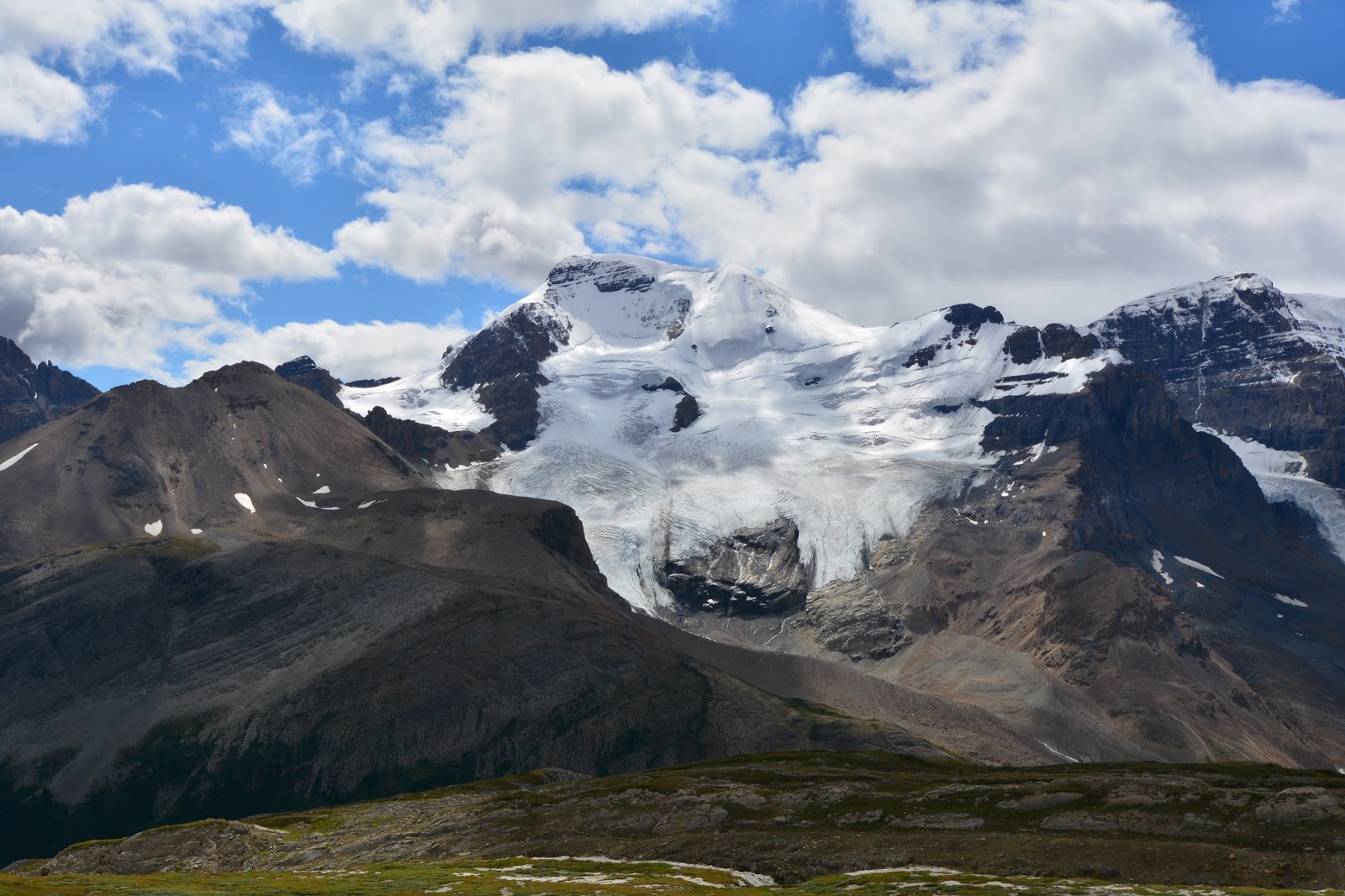
Mt. Athabasca and Mt. Saskatchewan with the Saskatchewan Glacier.

Alpine valley at Wilcox Pass.

Brazeau Range on the other side of the pass.

Looking south with the Icefields Parkway in the valley.

We took a side trail over to another great viewpoint, at a precipice just above the Icefields Centre. If the people in the bottom left took 5 more steps they would be over the edge.

Great view of the Athabasca and Saskatchewan Glaciers.

Trail through the meadow, heading back down.

Thursday, August 6, 2015

Evelyn Creek section of the Skyline Trail

A light rain did not keep us inside but it did influence our decision to take a forested trail rather than one above the treeline with grand, sweeping views - which today would have been of the clouds. We decided on the first section of the multi-day Skyline Trail, from its trailhead at Maligne (pronounced mah-LEEN) Lake to the 1st campground 4.8 km, or 6.58 miles round-trip on the Fitbit (we took two side trails, one to Lorraine Lake, and one to Mona Lake).

At km 2.2 we arrived at Lorraine Lake. Lorraine Magstad's parents worked at the Maligne Lake chalet in the late 1920's.

Lorraine Lake from the trail, through the trees.

Next up, at km 2.4 was Mona Lake. Notice the loon - bottom left in the picture. Mona Harrigan Matheson was Jasper's first licensed female trail guide. 

Mona Lake from the trail. Both Lorraine and Mona Lakes lie in hollows formed when a huge landslide tumbled down the ridge on the other side of Maligne Lake thousands of years ago blocking the valley and enlarging the lake.

The bridge at Evelyn Creek campground. "Evelyn" was one of two persons - the wife of the first resident Superintendent of Jasper National Park in 1913; or, the Duchess of Devonshire, who visited Jasper in 1920.

From the bridge at Evelyn Creek there is a side trail that leads to the top of the Bald Hills which you can see in the picture above and which we climbed, by another route, on Monday (blog post for August 3).


At the campground at Evelyn Creek you can see the cross-bar and cables for raising food away from marauding bears.

Following are pictures of mushrooms which were particularly prolific along today's trail. We don't know if it is the damp weather or because it this their time of year, but here are some that caught our attention.


When we got back to the trailhead, in the rain, the mountains around Maligne Lake were obscured by clouds. We're glad we climbed the Bald Hills on Monday and had such terrific mountain views in the sunshine. 

Wednesday, August 5, 2015

Lac Beauvert and a visitor

You can't time the market and you can't time the weather. It rained most of last night and into this morning. The weather forecast on the phone indicated that there would be a break in the rain between 12 noon and 2 pm. We decided to go for a walk during that time frame but to also wear our rain gear. We lucked out - no rain and even some sunshine. but when we got back, around 4 pm, the rain came again.
Last evening, around dinner time, we watched this adolescent male elk browse through our campground and then, just behind the Airstream, lower himself to the ground for a little rest. He watched us while we ate dinner, and we watched him.

The hike we took today was around Lac Beauvert, just outside of Jasper and location of the Fairmont Jasper Park Lodge. Mary, Joel, is this the place where you crossed paths in Canada last summer? A beautiful golf course and the lodge property surround most of the lake.

Along the way we met Percy and Ellie Bell who were traveling clockwise around the lake to our counter-clockwise path. Canadians, Percy is a retired chemist, they have a home outside of Banff and spend the winters at an RV park, named The Fountain of Youth, near the Salton Sea in southern California. (We met them here on the east side of the lake and then again on the west side.)

An example of the lodge's lakeside chalets.

We are standing in front of the main lodge building and this is the view across Lac Beauvert. Maybe you can make out the golf course along the shore of the lake.


The main lodge building with some historic tent lodgings on the lawn.

The lodge from a quarter of the way around the west side of the lake.

We were standing on the far side of the lake taking a picture of the lodge and a couple told us about a tree with a hole in it, just down the path, that you could take a picture of the lodge through.

So here's the lodge through the tree and...

here's the tree with hole.

Tuesday, August 4, 2015

Kinney Lake at Mt. Robson Provincial Park

Today we travelled 50 miles to the farthest north point of the summer, to Mount Robson Provincial Park, site of Kinney Lake and the last described trail in Tim Jensen's book, The Best Day Hikes in the Canadian Rockies. Dominating the trail is Mount Robson, at 12,973-ft, the highest mountain of the Canadian Rockies.

It was another perfect day for hiking and the clouds are only now, at 7pm, beginning to arrive.

Mount Robson from the trailhead for Kinney Lake.

The trail winds through an old-growth hemlock (here a "new" growth is starting from an old-growth) and...

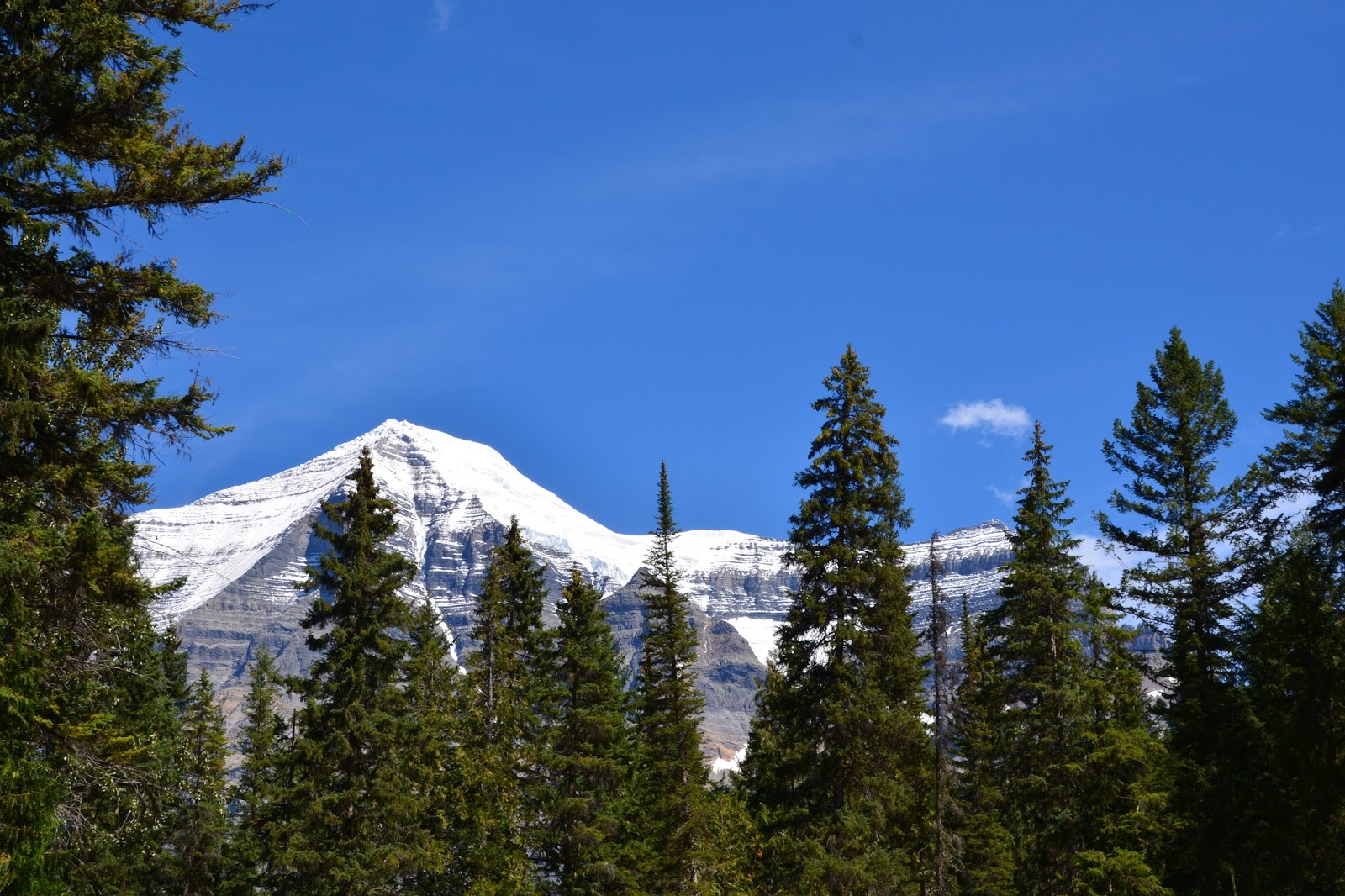
cedar forest as it follows the Robson River. That's Mt. Robson that you can just see through the trees. 

Mt. Robson from the trail showing the layer-cake nature of it's bedrock and the huge gully in the mountain's face. Carved by water, falling ice and sliding snow, the gully cuts through 9,840 vertical feet of rock strata and 60 million years of geological time.

The pale-orange band of shale, at the bottom of the picture, is the Arctomys Formation, six hundred and sixty feet thick. The Arctomys shale was originally laid down as fine-grained mud and the bright color of the rock is from iron oxide. All the rock in Mt. Robson was deposited bit-by-bit in the sea during the Cambrian Period about 510 - 570 million years ago. 

After about 3 miles we arrived at the Kinney Lake outlet, pictured at the bottom left.

Rounding a corner we came upon Kinney Lake.

Our lunch view.

We continued on for another 1/2 mile and saw the remains of an avalanche that has washed out the trail. We were re-routed up and over the debris.

The view across the north end of Kinney Lake.

Mt. Robson from the trail on our way back.

A face-on view of Mt. Robson from the Visitor Center.