Monday, August 3, 2015

Bald Hills

We have taken the cruise boat on Maligne Lake at least twice and I have looked at the surrounding mountain peaks and wondered what it would be like hike up into those magnificent mountains. Today was the day to find out.

The weather forecast for today was mostly sunny with a high of 88 in Jasper (with 16% humidity!) and the next few days look to have thunderstorms so we decided to hike the "outstanding" hike of Maligne Lake - Bald Hills. All the hiking books are unanimous in describing the views from the Bald Hills as some of the finest in the Rockies.

Although all are unanimous in extolling the destination they also admit that the hike can be quite strenuous because you reach the viewpoints in such a short distance. And, as most of the books say about strenuous hikes, the effort is worth it!! That is certainly true of today's hike. (Normally we wouldn't do three strenuous hikes on three consecutive days, but the weather does have a way of deciding things for us.)

Start of the trail. You can see the Bald Hills, bald with the absence of trees. 

The Bald Hills are actually a ridge with a series of lookouts, the highest being the summit of the second bald hill (7610-ft) which is crowned with a big, stoneman cairn. Here's Frederick approaching the summit.

He made it! - the huge cairn and our lunch spot

The Queen Elizabeth Ranges on the far side of Maligne Lake.

See the little cruise boat on Maligne Lake? Heading for Spirit Island, no doubt.

I was charmed by the rick-rack design on this mountain across the lake.

Lunch over we're ready to begin exploring some of the other viewpoints.

(If the above pictures look a little weird it's because I didn't check the camera setting and it was on "food". The lighting is a little off because of that.)

Hiking the ridge between viewpoints. The rounded shapes of the Bald Hills indicate that they were completely covered by glacial ice during the Late Wisconsin Glaciation. 

Looking back at the gigantic carin where we ate our lunch. The farther viewpoint looks like it is higher, but it's not. 

Frederick passing kruppleholz, nature's bonsai. This is looking north and you can see where the Jacques Lake Trail (blog post for August 2) threads between the Colin and Queen Elizabeth ranges. 

This mountain range is called the Endless Chain Ridge.

Heading down off the second viewpoint. You can see that trails go off to a number of other viewpoints that will have to wait for another day. This is looking south where you can just see Mt. Columbia, North Twin, and Mt. Alberta, respectively 2nd - 3rd-, and 6th-highest peaks in the Rockies; and 1- 2 - 3 in Alberta.

Another view of Maligne Lake.

The highest peak (just cut off) is Samson Peak, over 10,000-ft, and the highest in the Queen Elizabeth Range.  See the little cruise boat in the center bottom of the picture?

View toward the rust-colored Opal Hills (blog post August 1).

One last look at Maligne Lake as we begin to head down.

Samson Peak above the trees as viewed on the trail down.

Opal Hills on the way down.

Almost down and Maligne Lake through the trees.

A look up at Opal Hills.

Sunday, August 2, 2015

Beaver, First & Second Summit, Jacques Lakes and dining with a moose

After yesterday's steep climb up to Opal Hills we decided on what Tim calls "a truly unique" trail, "ideal for those of you seeking to avoid strenuous hikes with major elevation gain." Well, it may not have had major elevation gain, but we still achieved 118 floors (Edith Cavell- 202 floors; Opal Hills- 183 floors) and the distance to Jaques Lake was long, 16 miles, and it took us 7 hours! We did achieve over 40,000 steps today.

The elevation chart looks dramatic, but if you look closely you will see that the distance between the lines is only 100 meters.

Near the beginning of the trail. Beaver Lake, which you might be able to see through the trees, is only   1 mile from the trailhead.

Two more views of Beaver Lake - this one looking south and...

this one looking north. That is the Queen Elizabeth Range.

First Summit Lake, 3 miles from the trailhead. Visible up-valley is Colin Range.

Second Summit Lake, 3 1/2 miles from trailhead.

Frederick in a cloud of horsetails on the way from Second Summit Lake to Jaques Lake. 

Traveling down the west side of Jaques Lake we spied a moose near the north end of the lake.

He didn't seem...
to be bothered much...

 by an audience.

North end of Jacques Lake with the Jacques Range visible over the trees.

We sat and ate our lunch at the bridge over the north end of the lake and watched the moose enjoy his meal, too.

Saturday, August 1, 2015

Opal Hills

The other good news about Jasper while we were gone, in addition to the weather turning nicer, is that the wildfire has been put out and the road all the way to Maligne Lake has been opened. That means that a number of hikes, in our trail guide books, are now available.

At Opal Hills, according to our man Tim Jensen (The Best Day Hikes in the Canadian Rockies), we "will enjoy the amazing panorama that ranks as one of the top views in Jasper National Park. Alpine wildflowers are most abundant between the end of June and early August and the Opal Hills meadows are a great place to see them. Opal Hills is not really a long hike (5.4 miles) but it is a steep one. You must overcome 500 meters (1640 ft) of elevation in the first mile and a half hiking."

We got a late start, just after 2pm, so this is just the type of hike we were looking for - short but challenging. The ascent lacked switchbacks so it was just about straight up the mountain. But - as all the books say - the views are "worth the dramatic energy expenditure". We agree.

No pictures on the trail coming up - it was all we could do, with our heads down, to ascend the steep climb on a poorly conceived and heavily eroded trail. 
Here we are, at the summit of Opal Hills and crossing a rivulet with some wildflowers on the right.

Looking across the upland meadow at some on the surrounding peaks.

Fields of...

wildflowers.

Maligne Range in the distance. 

After crossing 1 1/2 miles of meadows we begin our descent on an easier, less steep trail of the loop.

Maligne Lake from the descent trail.

On our way back into Jasper town we passed these big-horned sheep out for a stroll.

Scenes from the fire...

that burned an area around Medicine Lake that is about 1/2 way along the road to Maligne Lake.


This is the southern reach of the fire. You can see sections of the forest that have burned and sections that did not.

Edith Cavell Meadows II - Kruppleholz: nature's bonsai

We're back in Jasper after a whirl-wind visit with Marlene, and her family, and to get the car serviced in the good old U.S. of A. The visit was all too brief but the good news is that we will be returning to the Coeur d'Alene area at the end of August and we will have more time to visit then.

In the meantime, while we were away from Jasper, the weather has taken a turn for the better. In fact, today was a perfect day! Because it was so nice, we decided to re-do a hike we had done earlier (July 15 blog) to the Angel Glacier and Cavell Meadows. Some contrast pictures are included in today's blog.

But before we get to the hike, here are some pictures from the past three days.

Two weeks ago my iPhone 6 had a bad day and remained black no matter what we tried. Working through the problem with tech support (she got the phone to wake up by having me press the home button and the on/off button at the same time), she wanted the phone checked out at an Apple store in case there was a software issue. So while the car was being serviced we went into Spokane to the Apple store in River Park Square Mall. Everything is okay with the phone and here's Jordan cleaning up my computer so that it looks shiny new. 

Another thing that we did while the car was being serviced was to check out River Side State Park as a possible location to park the Airstream when we return in August. In the campground office Frederick mentioned that he remembered coming to the park when he was a very young boy with his family for picnics. He mentioned that he graduated from Mead High School and the woman behind the desk immediately replied, "I did too!". Jan Moulder graduated in '70, Frederick in '62, but Jan's older sister, Linda, was in Frederick's class. In fact, Frederick remembers squiring Linda to a formal dance when they were in high school together. 

This picture is for Peter - he knows what it means. It is a sign at a meat store in Coeur d'Alene. Kinda of reminds me of the picture of ...

the description of what happens when animals don't adapt to climate change. (see May 23 blog - Sheep Mountain Table)

The drive back into Kootenay/Banff/Yoho/Jasper from Idaho is spectacular with the Canadian Rockies much more of a presence than the views coming into Banff from Calgary.

We entered Kootenay State Park through Radium Hot Springs and checked out the Redstreak Campground where we have reservations after we leave Jasper. On the way into the campground we spotted this big horned sheep.

Driving from Kooteney into Banff, Castle Mountain greeted us like an old friend.

We also checked out Kicking Horse Campground in Yoho, just down the road from Takaka Falls. This  picnic spot is called "Meeting of the waters" where there is a marked contrast in the color of the milky Yoho River, caused by glacial silt, and the clearer Kicking Horse River. 

Today, as I said, was perfect for hiking and it was a real pleasure to revisit Cavell Meadows.

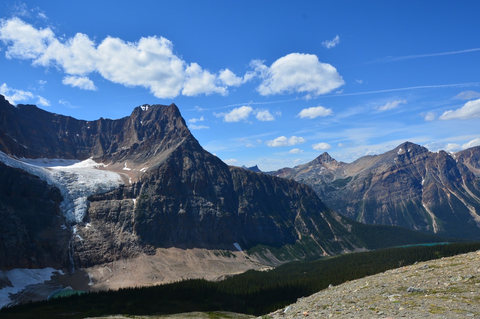
Angle Glacier

Angle Glacier too weeks ago, on July 15


Frederick standing by "kruppleholz", nature's bonsai. At the edge of the treeline, harsh winds and cool temperatures have shaped and stunted these evergreens, some of which are over 100 years old. 

Once again we climbed to the top of the highest viewpoint on the Cavell Meadows Loop Trail. The views today were spectacular. 

July 15 - two weeks ago


From the highest viewpoint today

Frederick - see him at the bottom center - on the way back down from the viewpoint.

Wildflowers in a mountain meadow.

Angel Glacier with icebergs floating in the lake below.